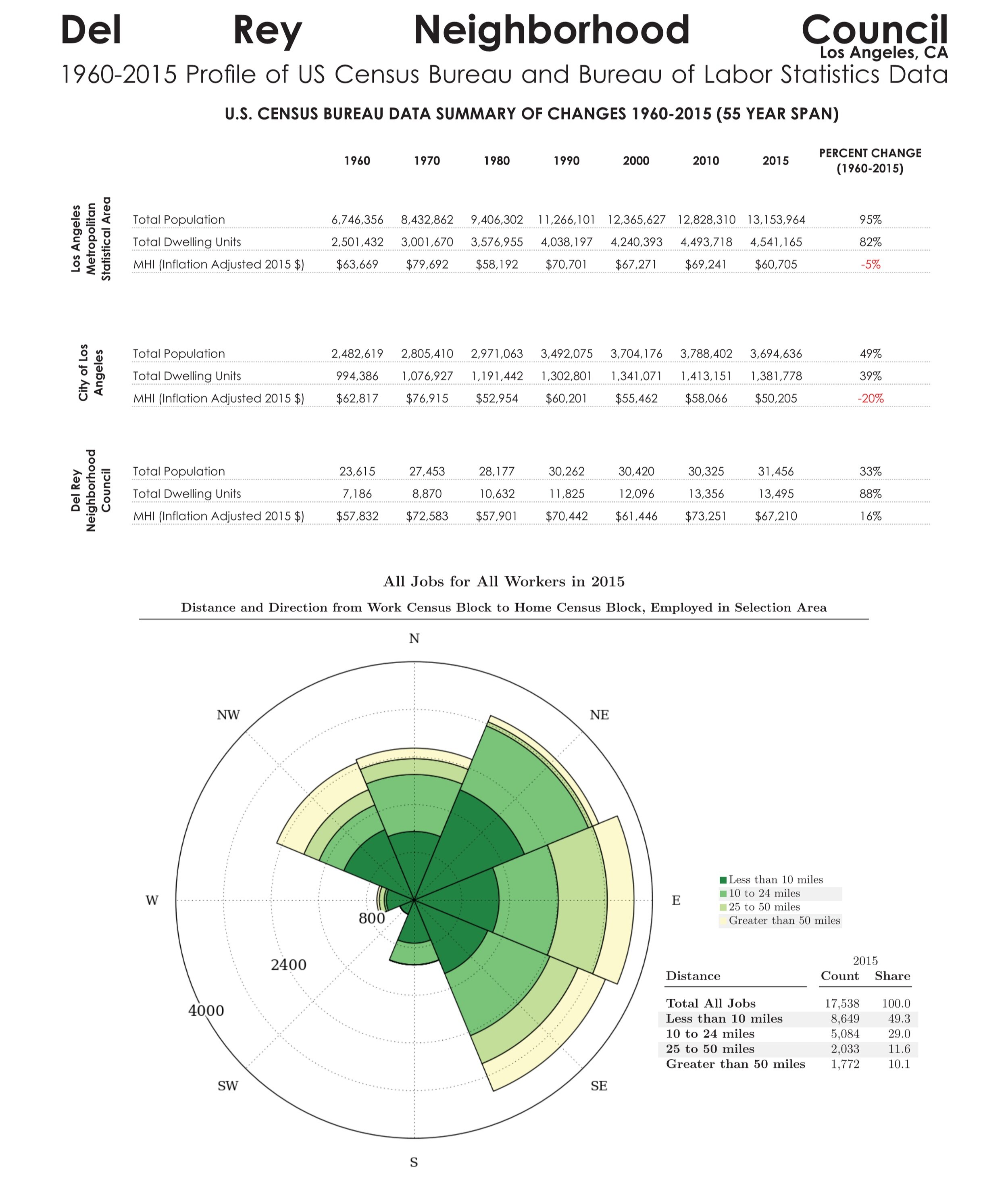
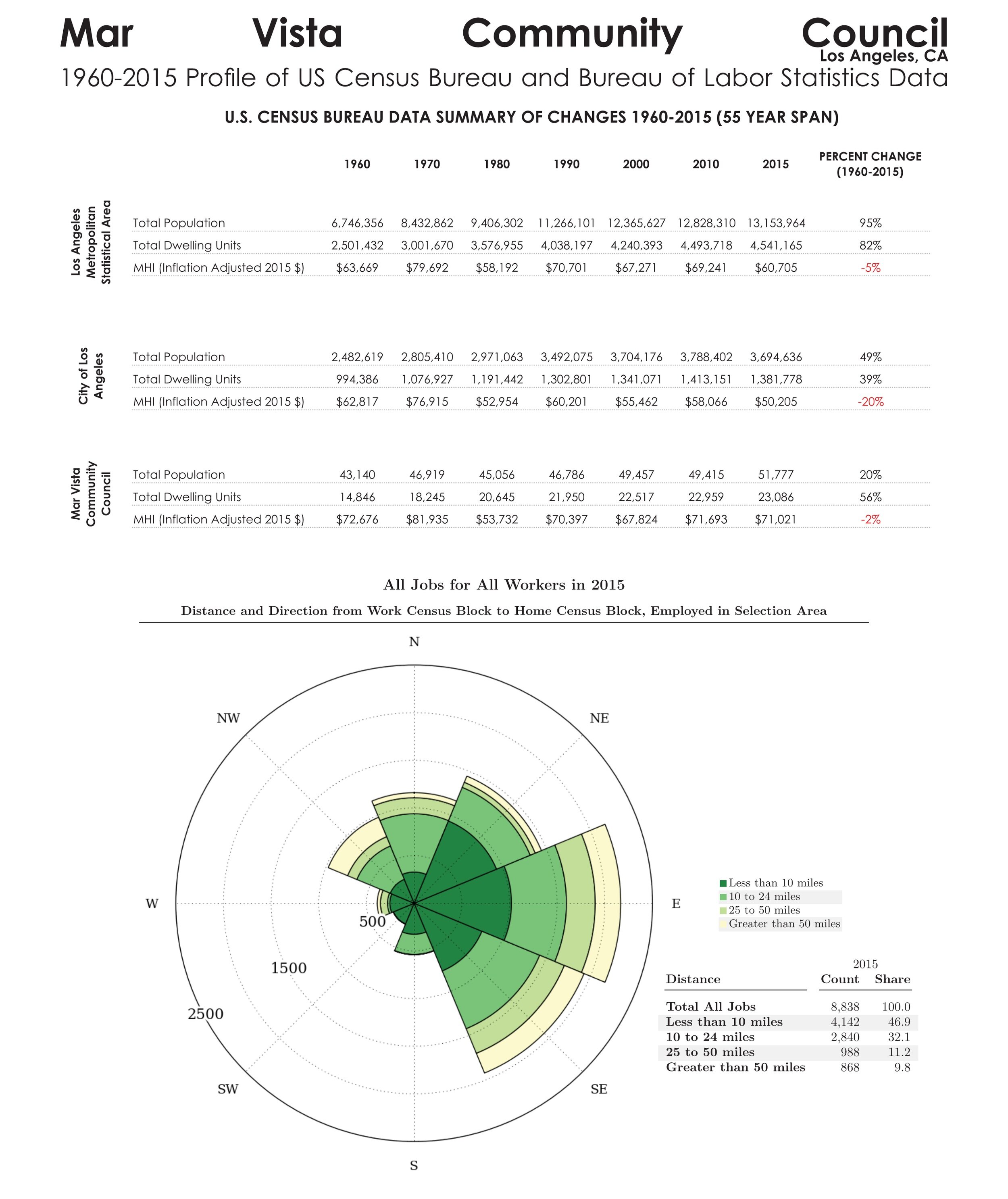
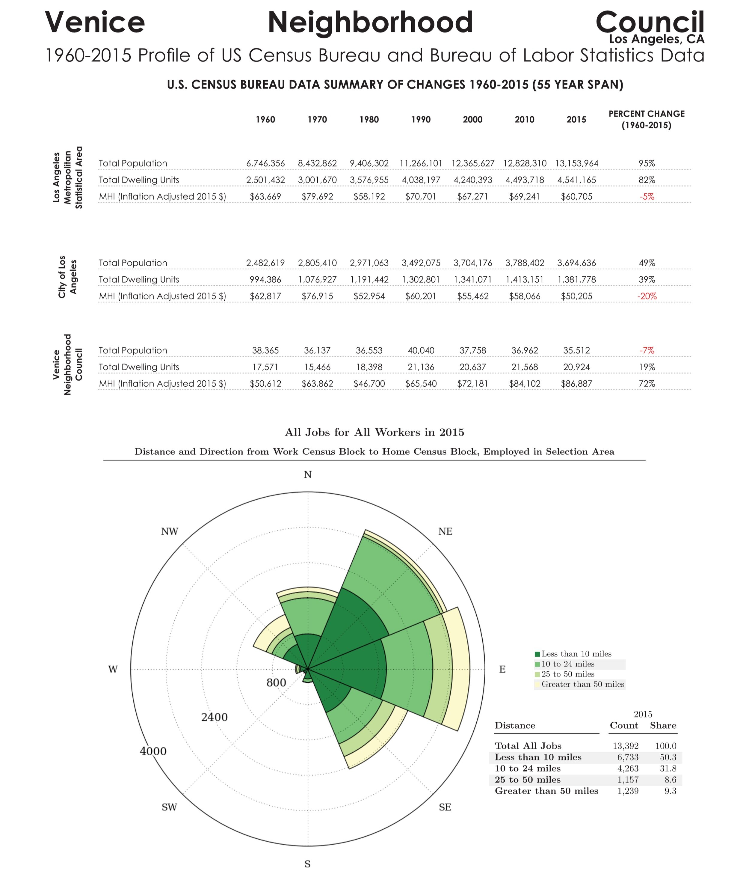
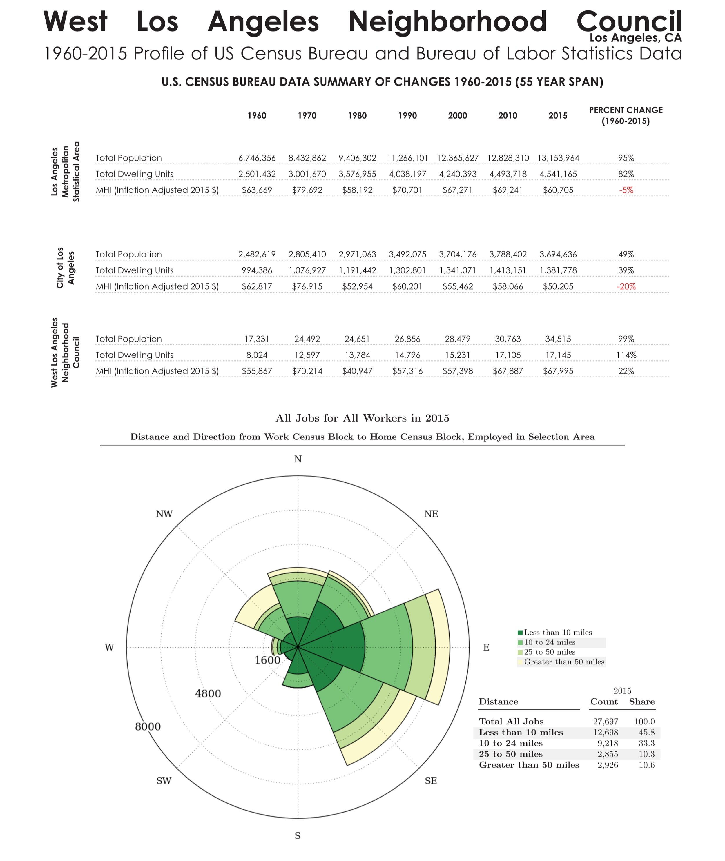
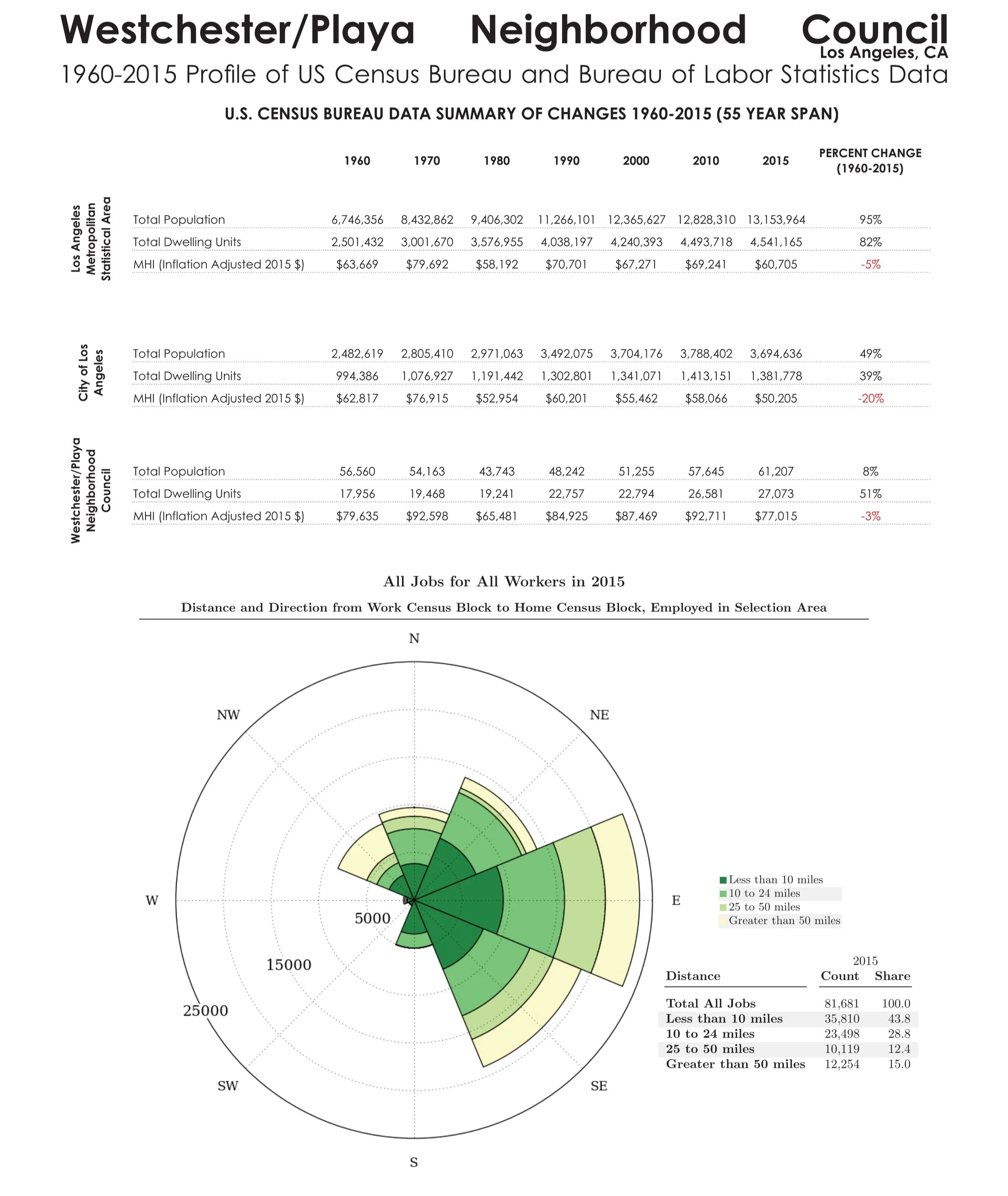
u.s. census bureau data trends 1960-2010
VENICE, CALIFORNIA AND THE LOS ANGELES METROPOLITAN AREA
Suggested citation:
Rodman-Alvarez (2017) U.S. Census Bureau Data Trends 1960-2010, Venice, California and the Los Angeles Metropolitan Area. Los Angeles, CA. Pacific Urbanism. Retrieved from https://www.pacificurbanism.com/research-publications/veniceneighborhoodcouncillandusezoning
To read our report on land use and zoning trends within the Venice Neighborhood Council, the City of Los Angeles, and the greater Los Angeles metropolitan area, click “Download PDF”. The tables, graphs, maps and data included in this report were presented to the Land Use & Planning Committee (LUPC) of the Venice Neighborhood Council (VNC) on March 29, 2017. The data analysis performed for this report has subsequently developed into further presentations and research publications:
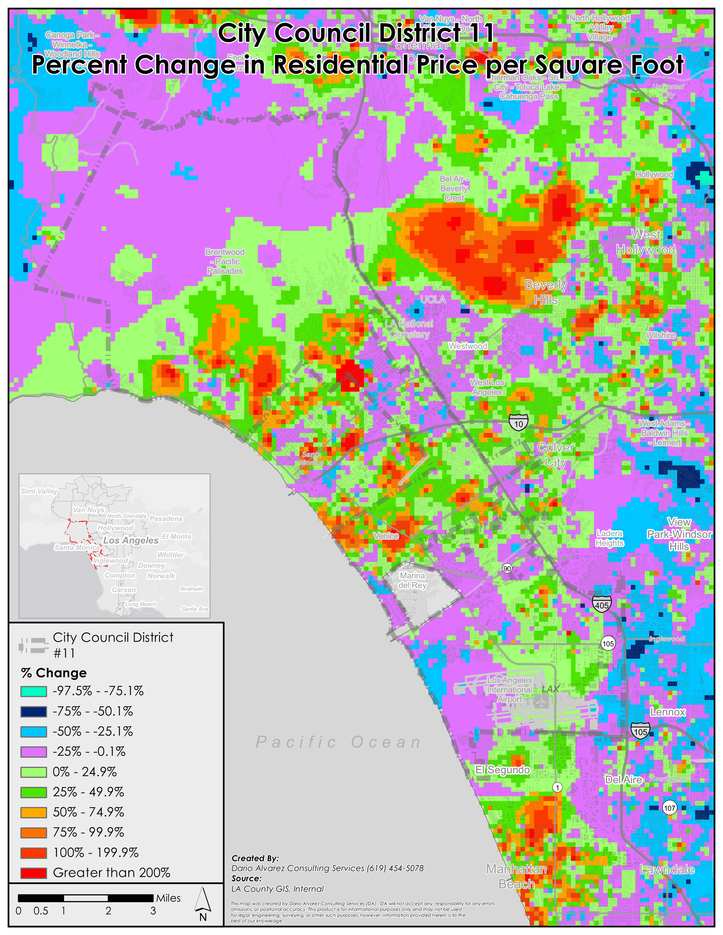
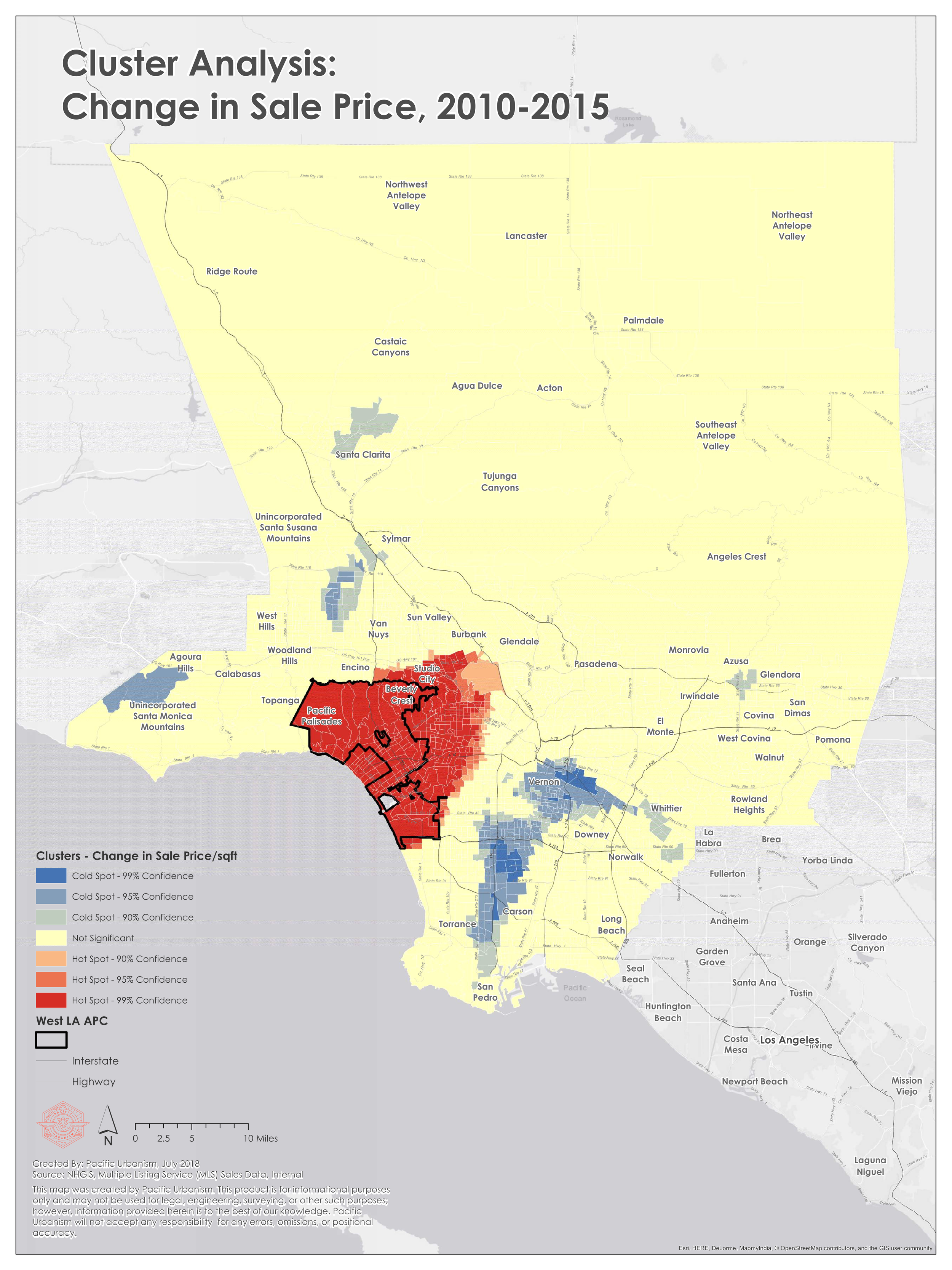
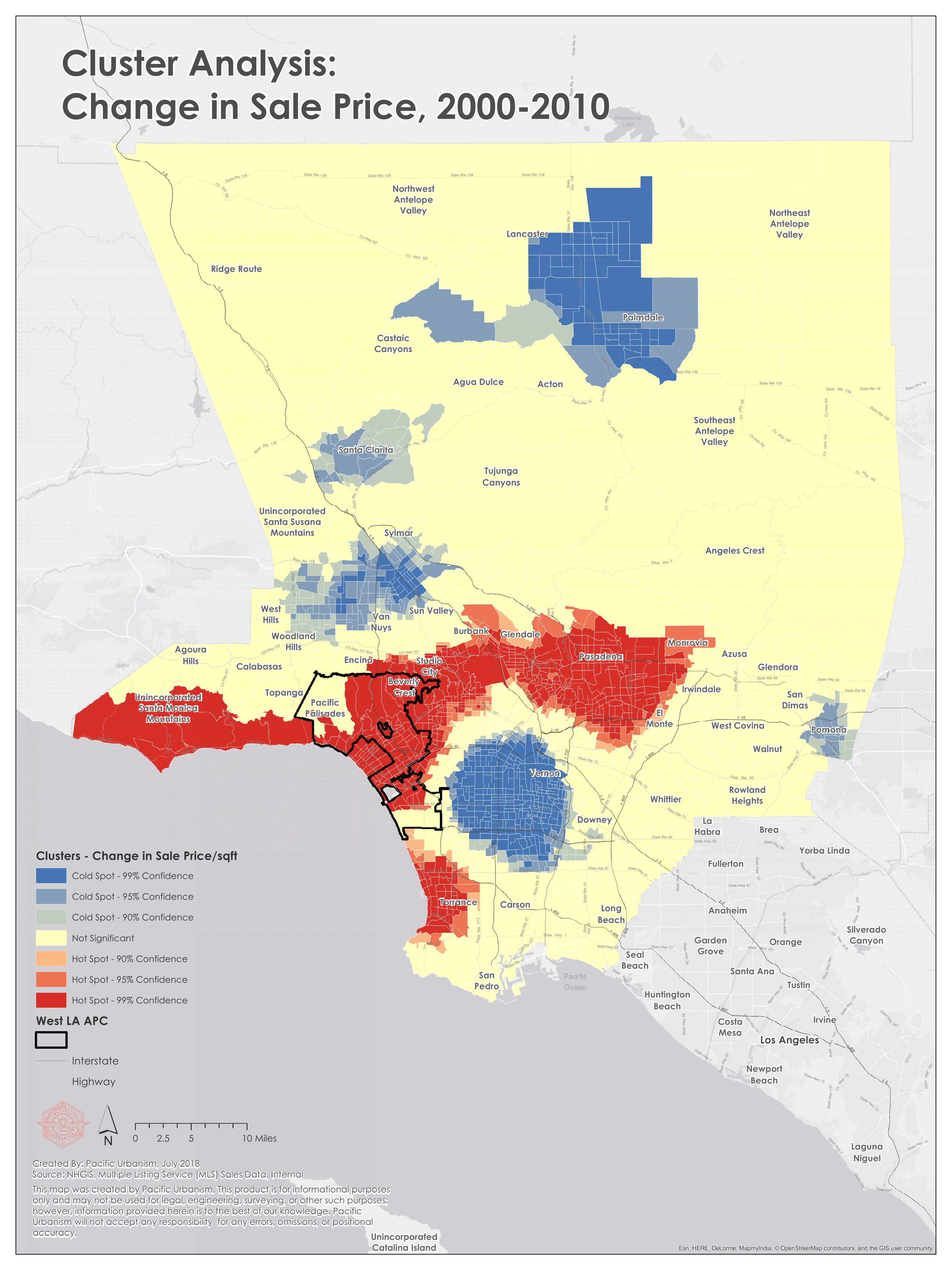
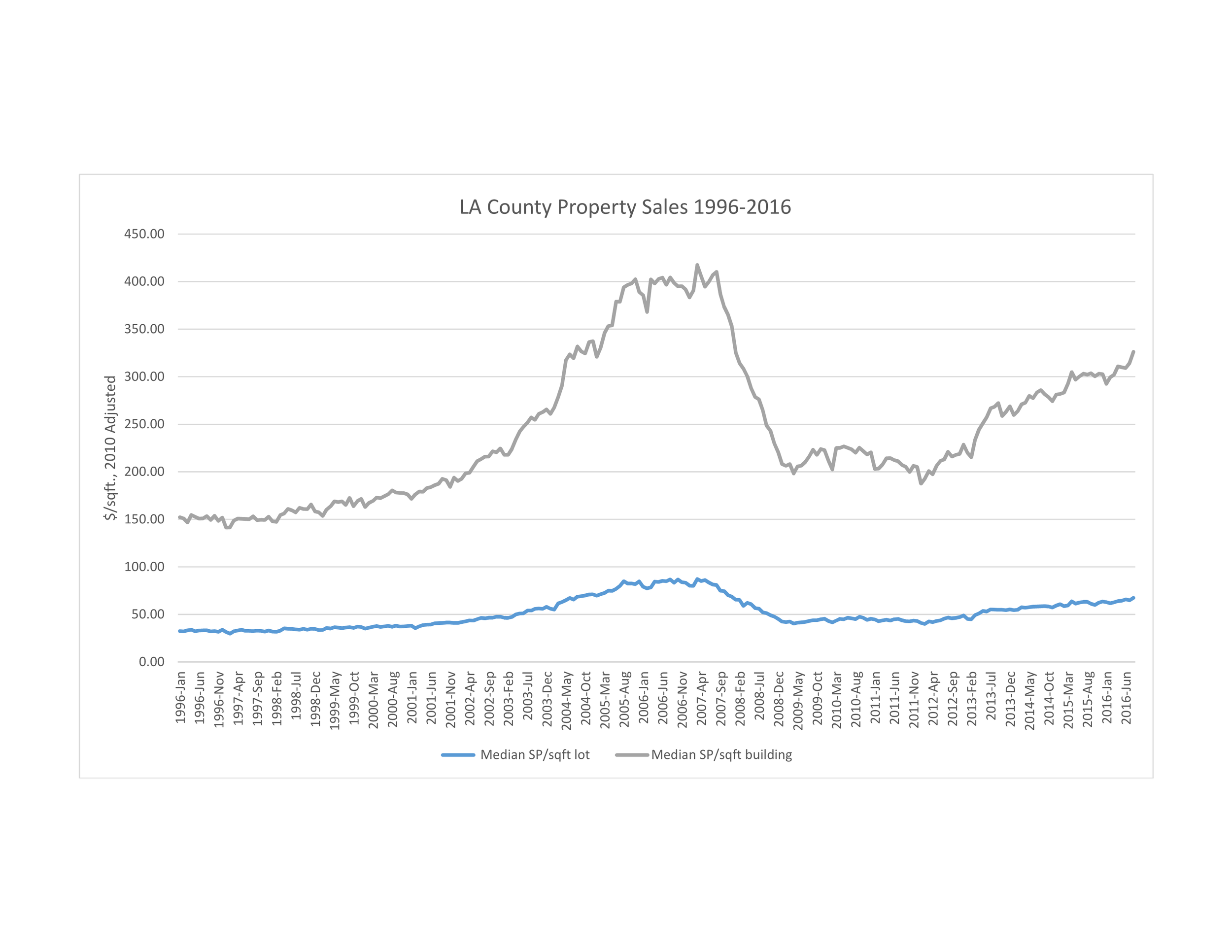
West Los Angeles Area Planning Commission (WLAAPC)
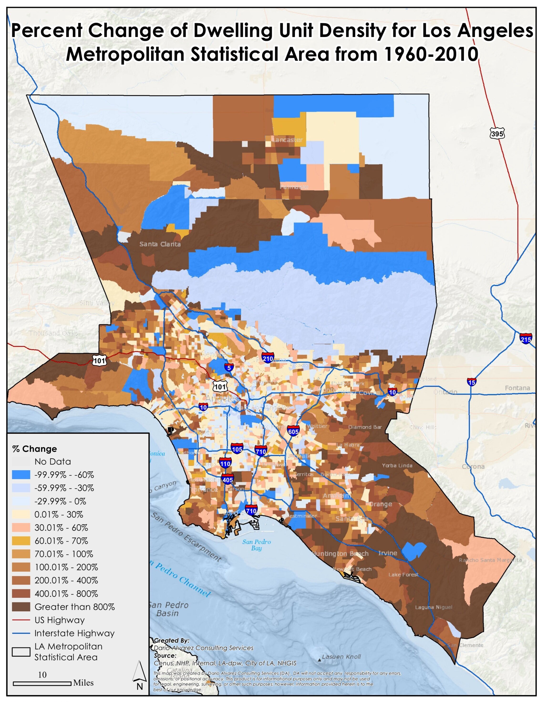
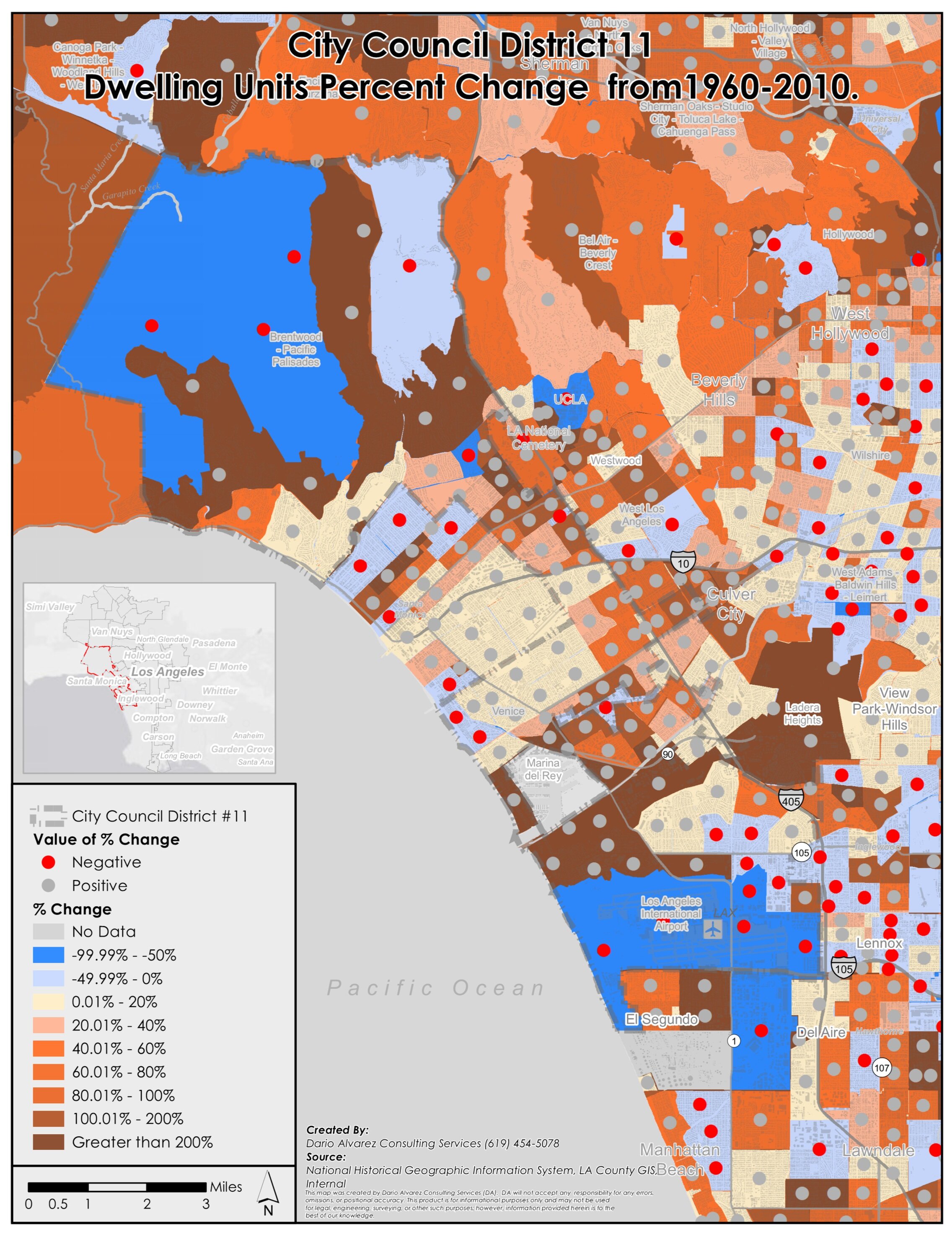
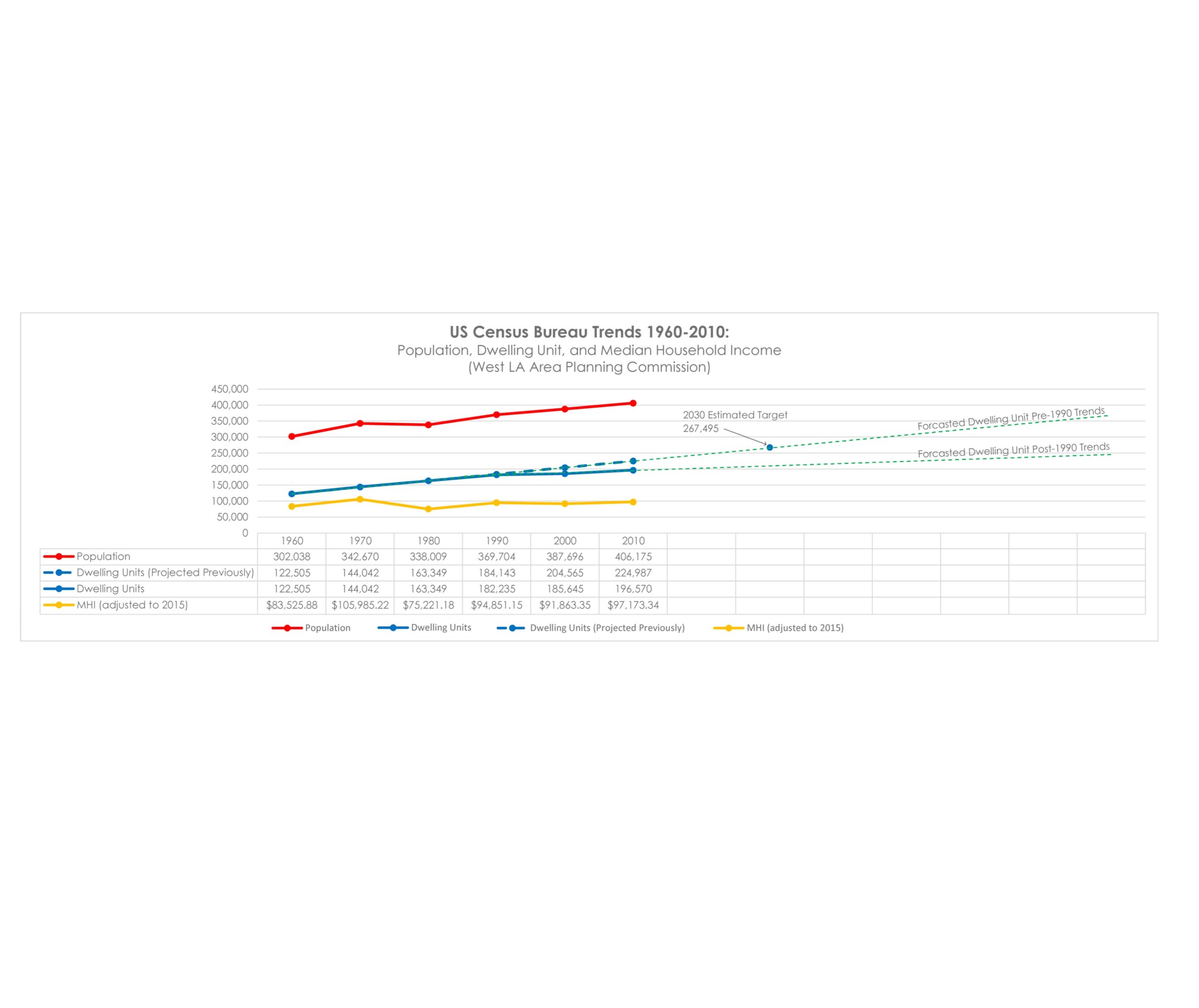
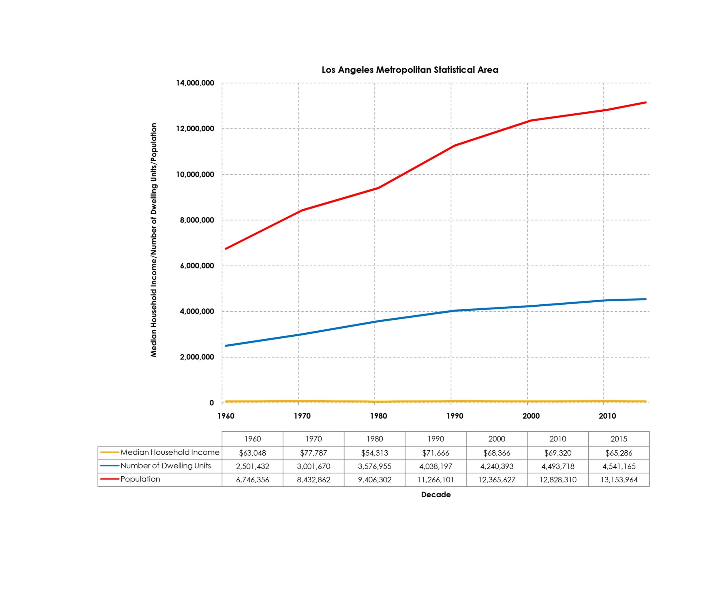
In 2019, Pacific Urbanism presented to the West Los Angeles Area Planning Commission (WLAAPC) regarding land use and zoning trends from 1940-2015 within the westside of Los Angeles as well as the Los Angeles Metropolitan Statistical Area (LA MSA).
Click here to download the PDF
Click here to download the presentation audio
The Venice Plan for Historic Oakwood to Meet 2029 Regional Housing Needs Assessment (RHNA) Targets
In 2020, Pacific Urbanism collaborated with Venice community members to conduct research on the history of land use and zoning in Venice and prepare recommendations to public agencies regarding the community’s desires for the future of their neighborhood.
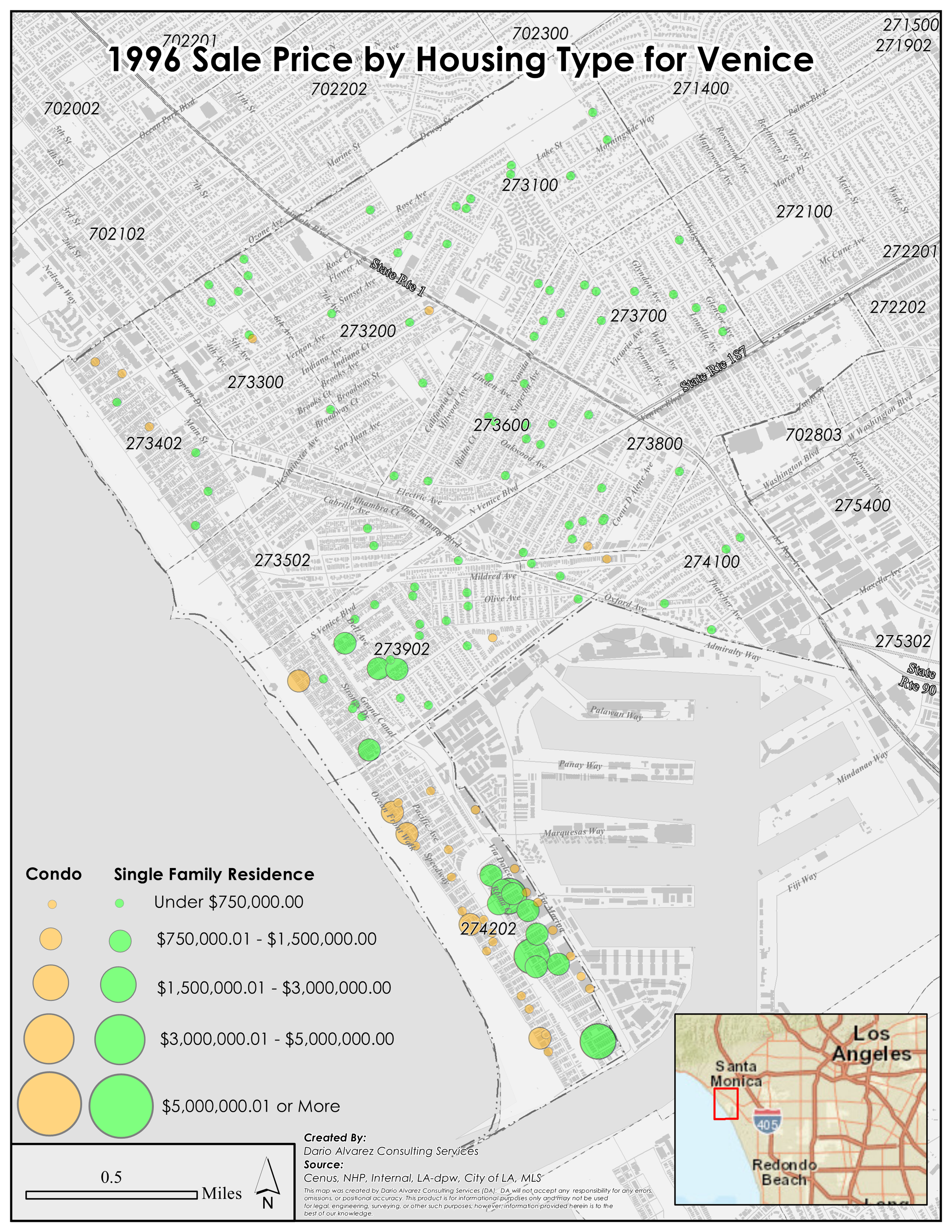
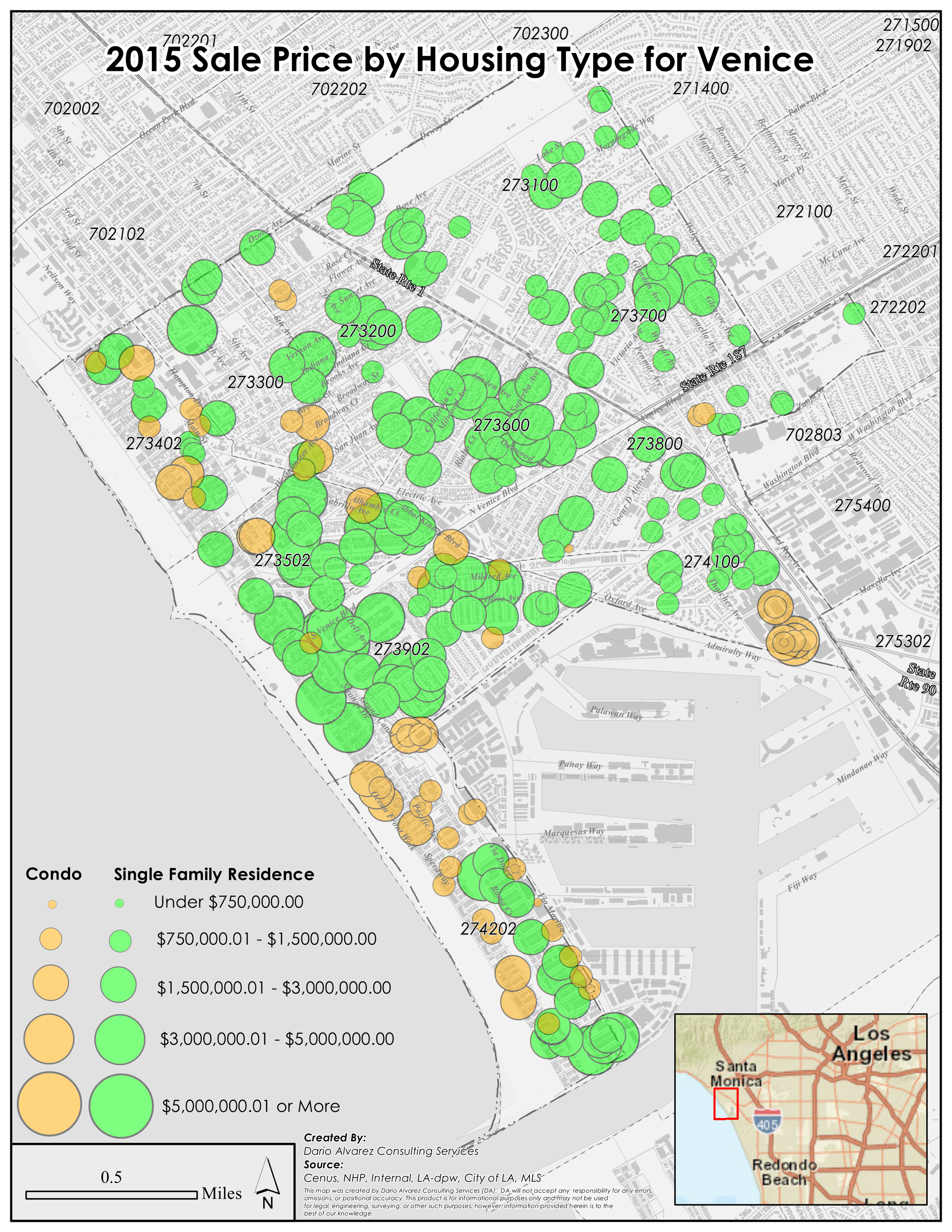
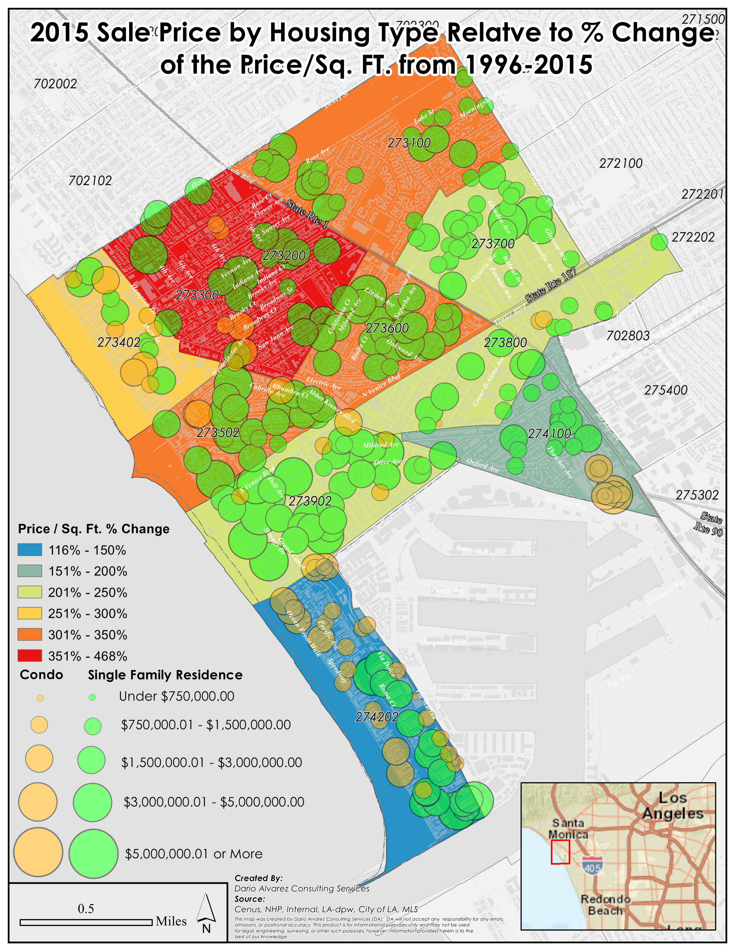
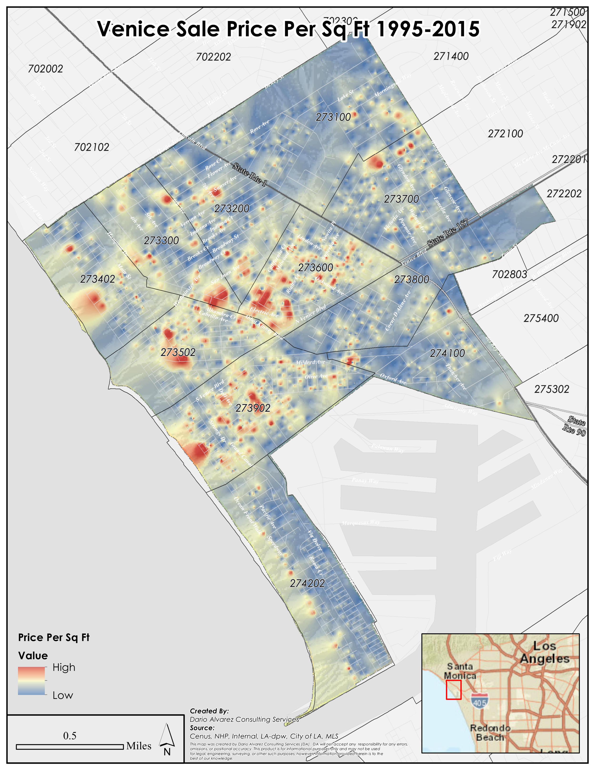
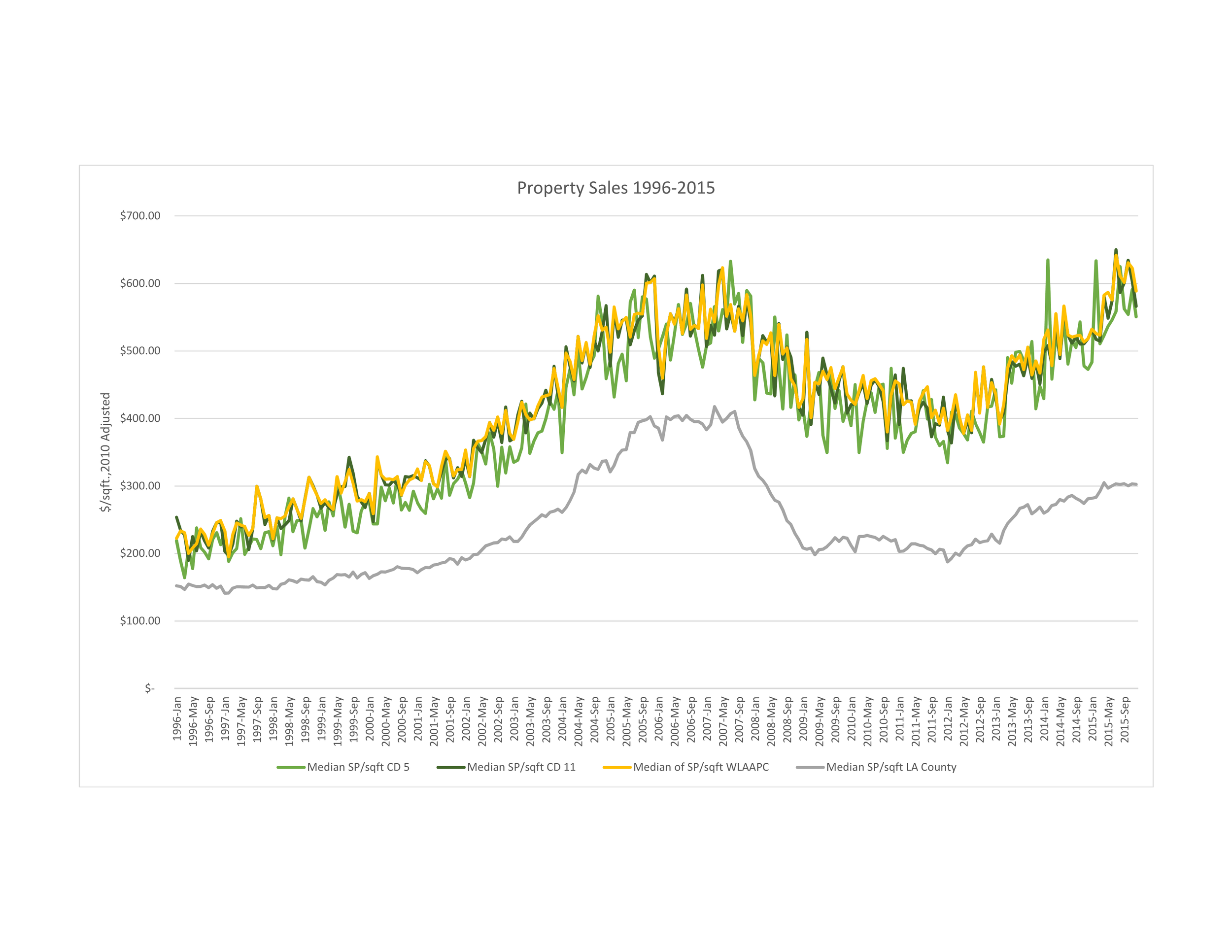
HOUSING PRICE & AFFORDABILITY ANALYSIS
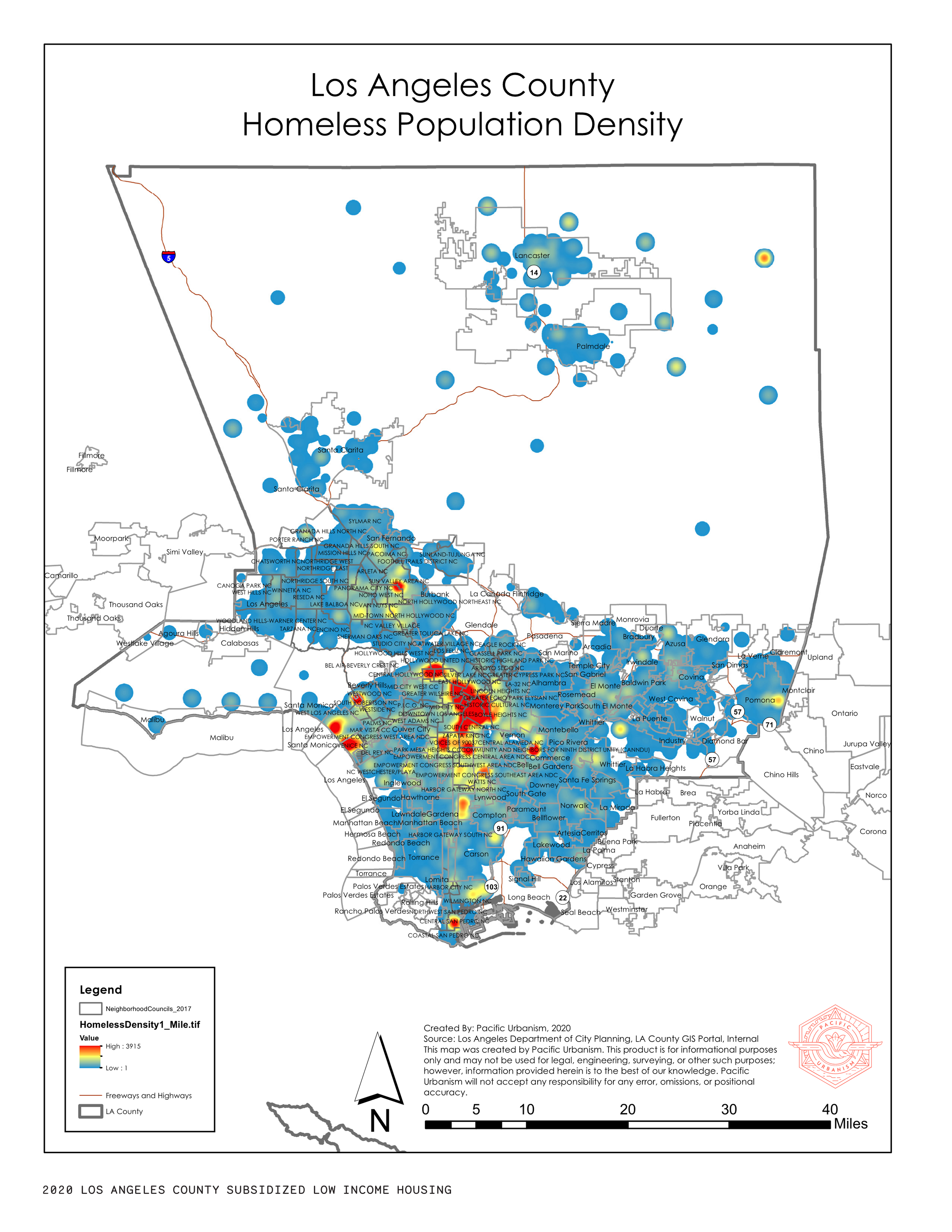
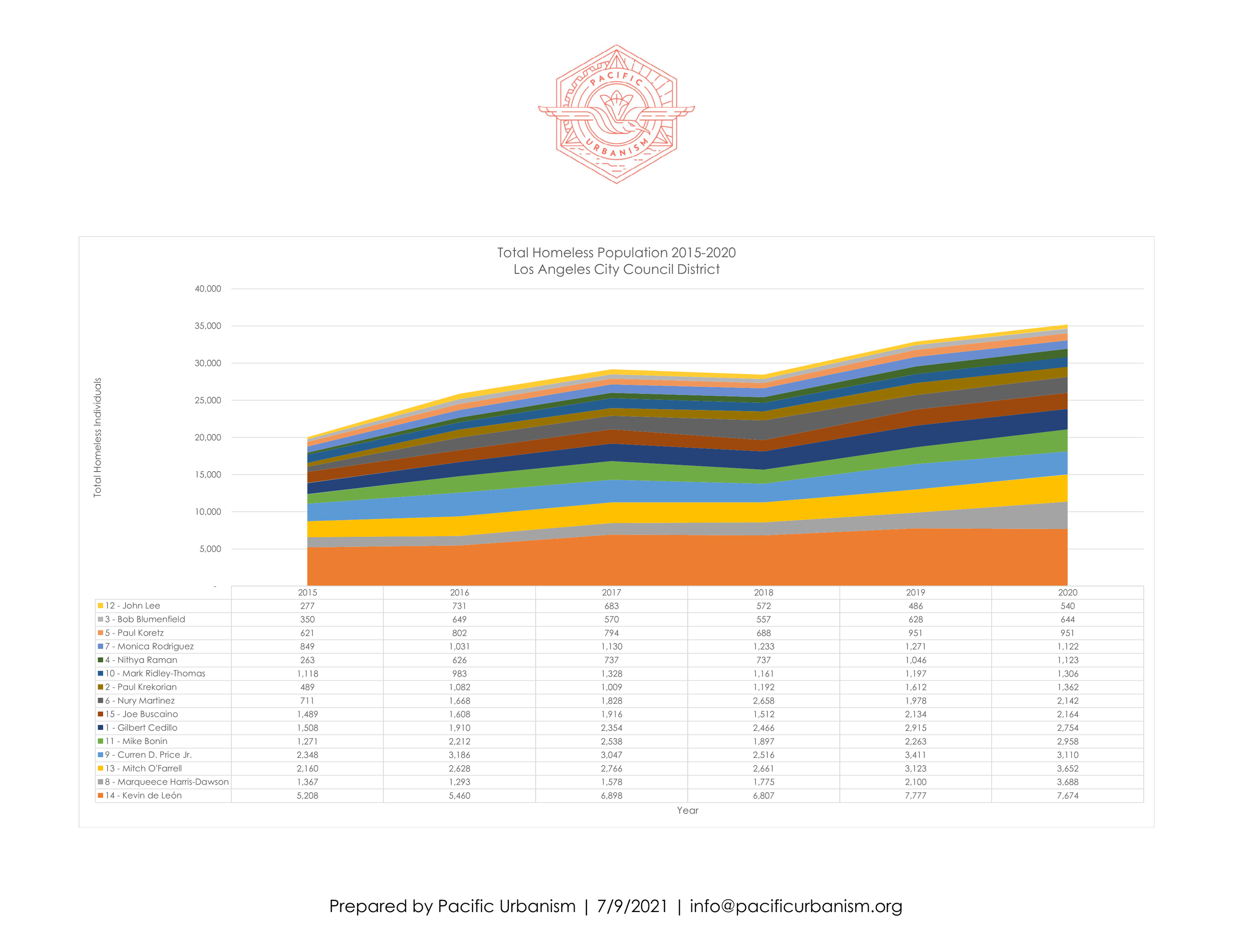
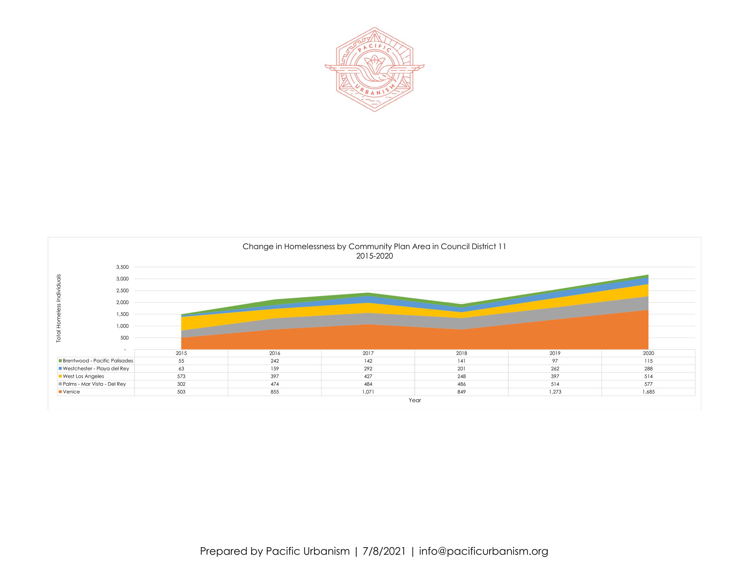
Homelessness
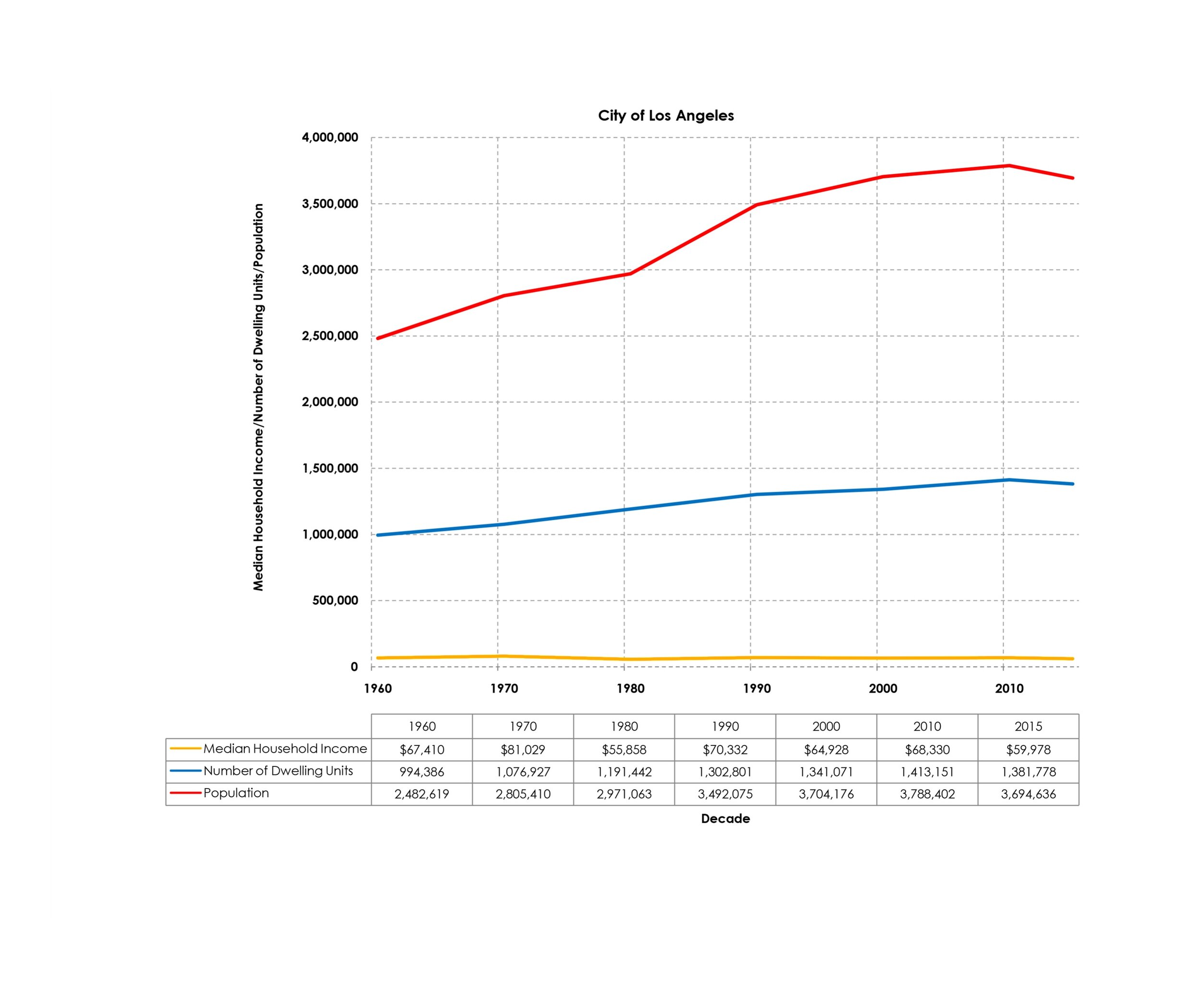
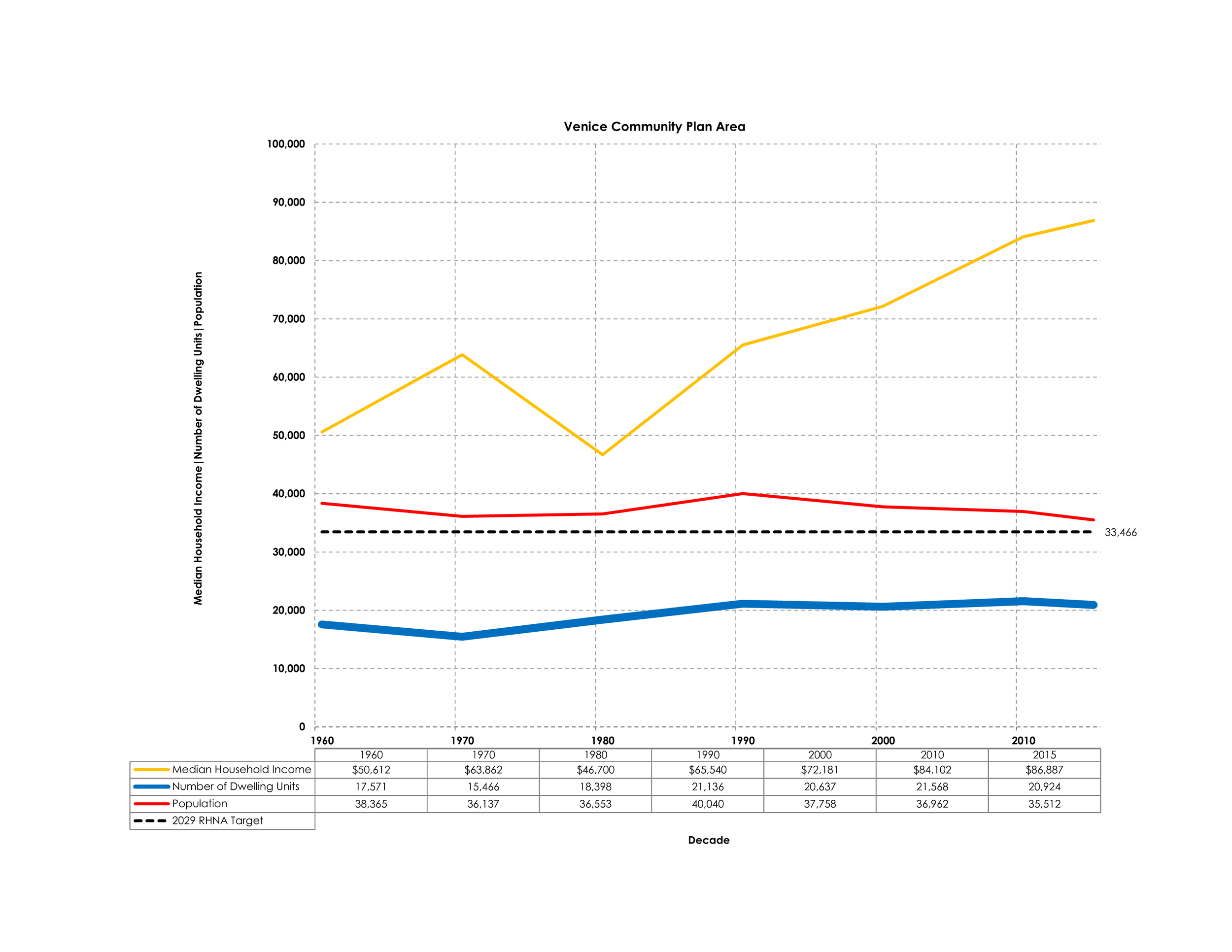
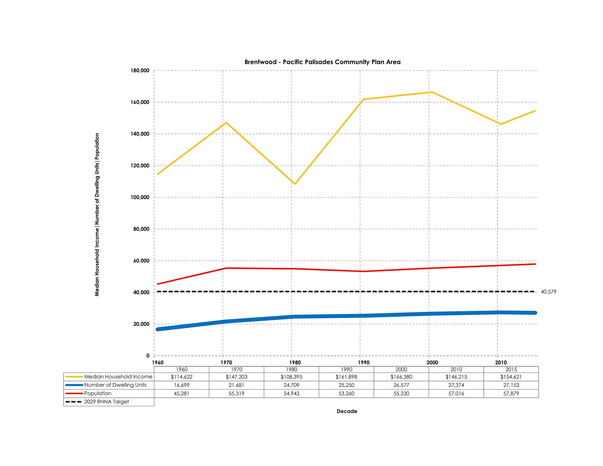
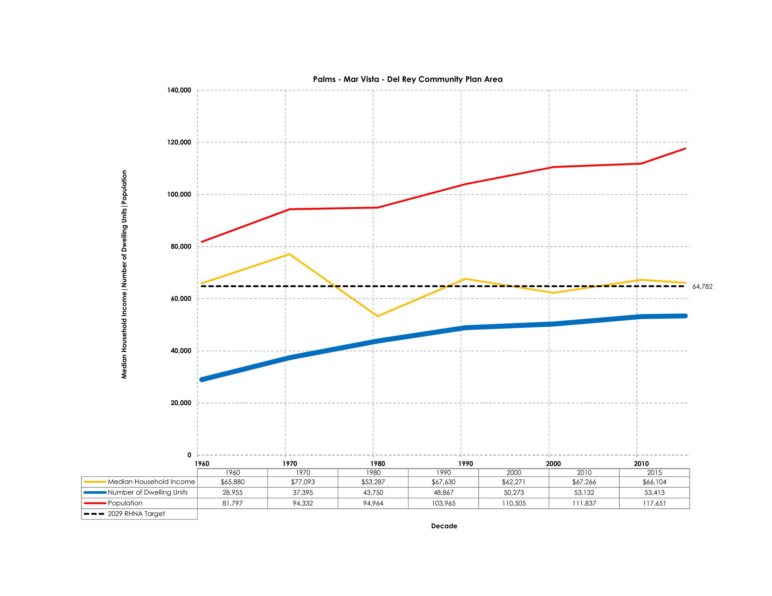
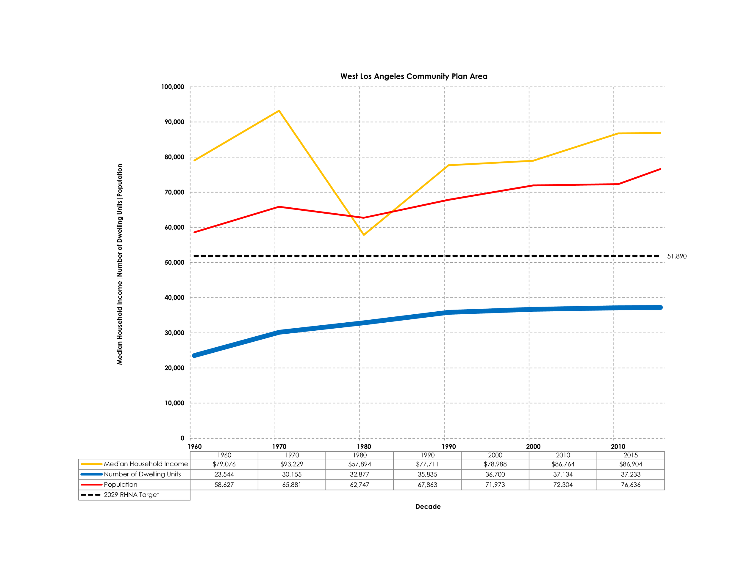
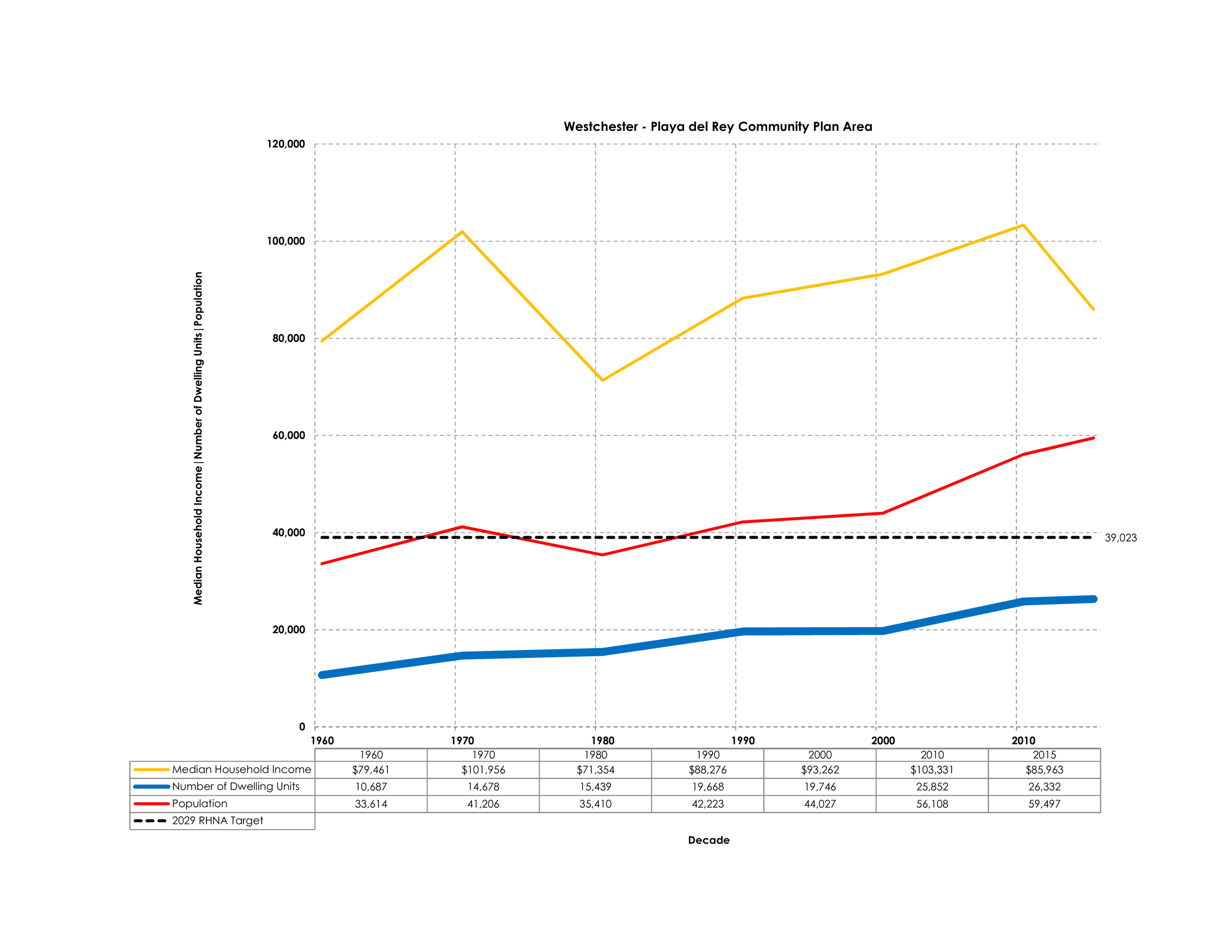
CENSUS DATA BY COMMUNITY PLAN AREA
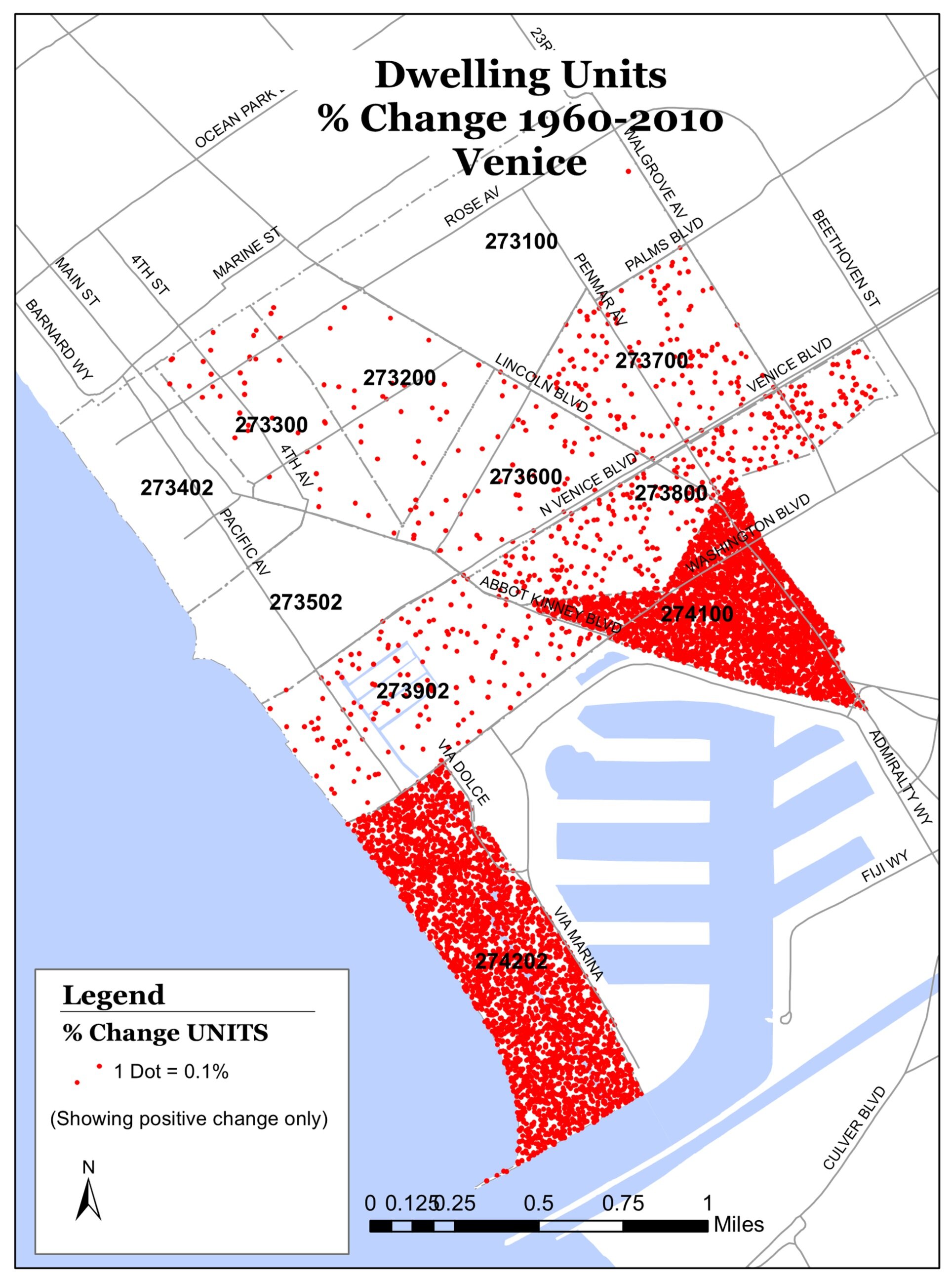
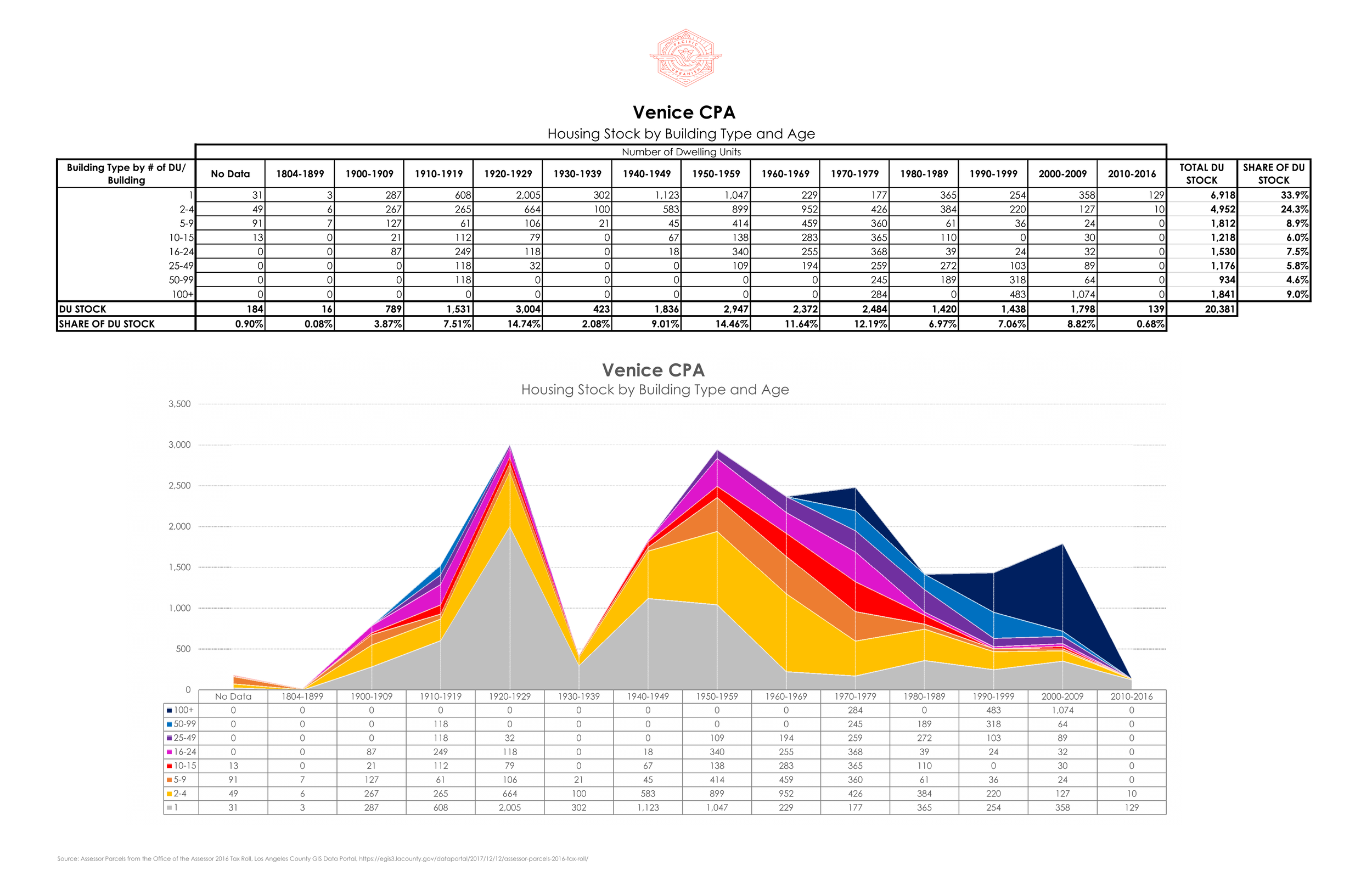
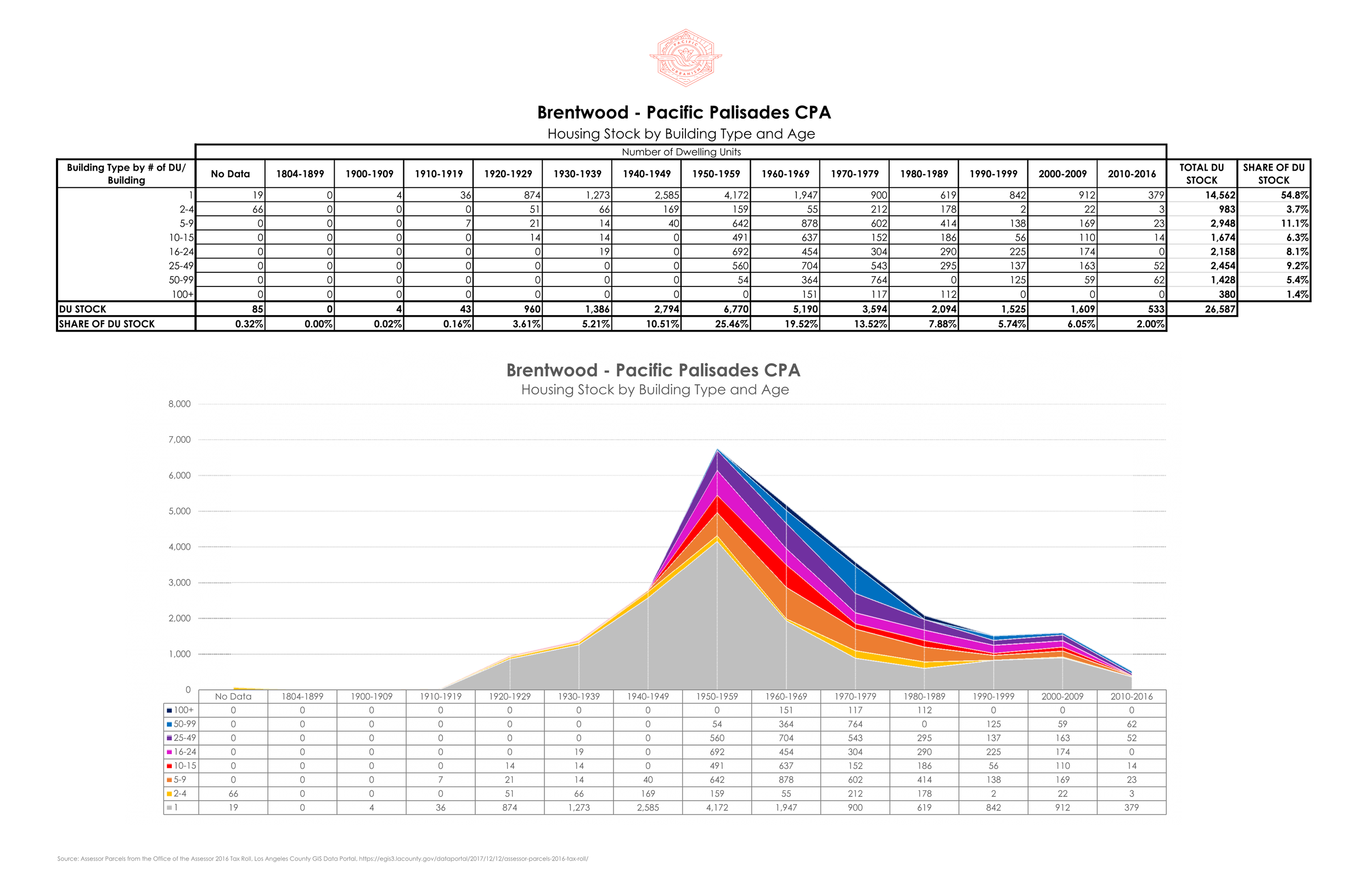
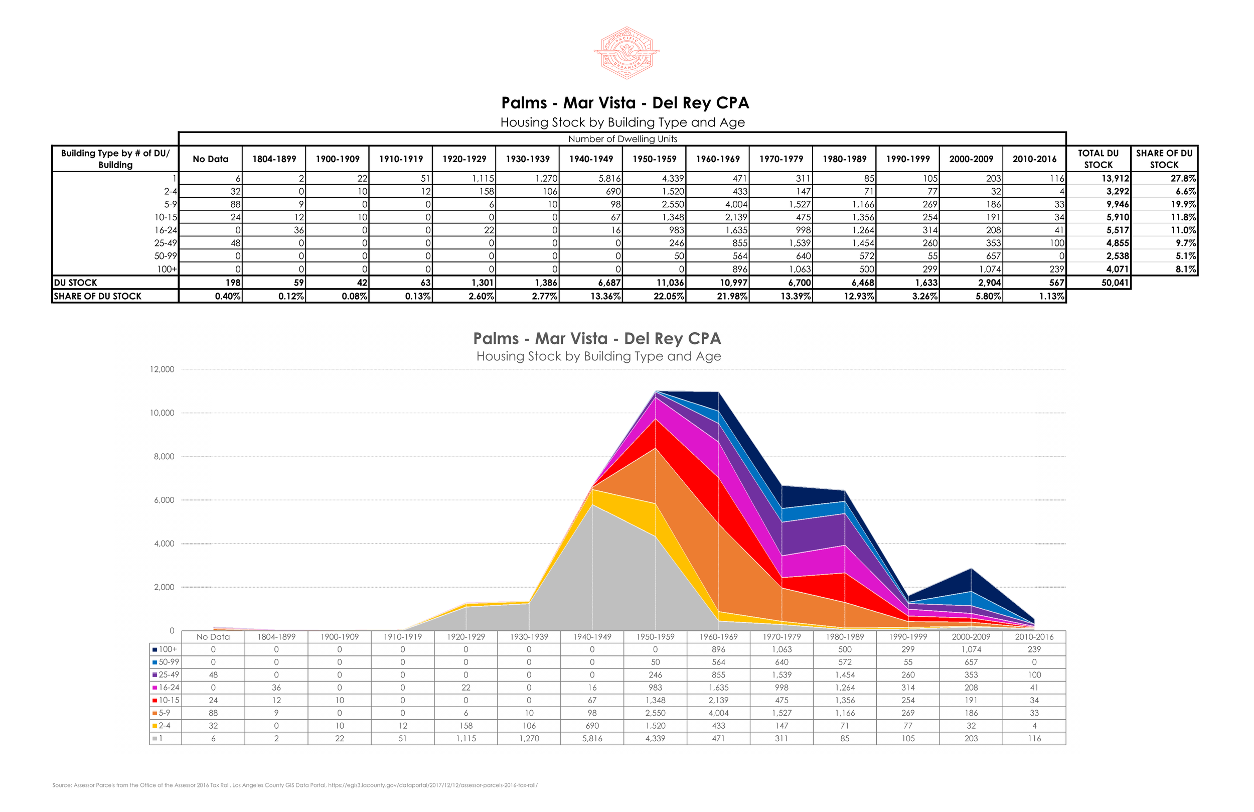
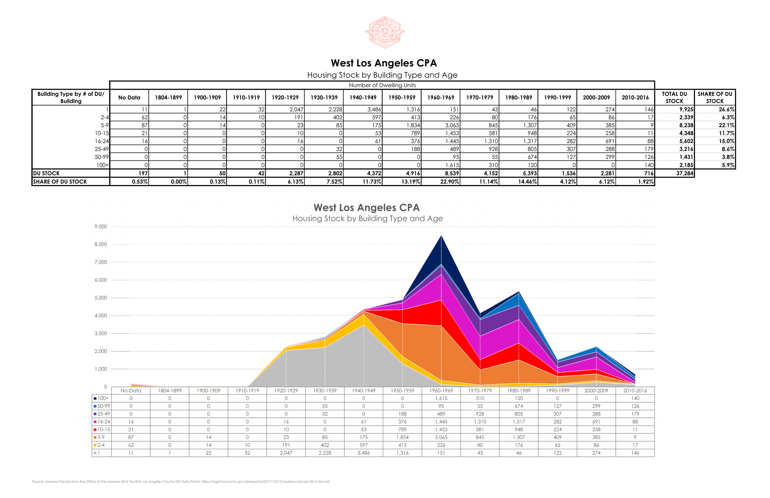
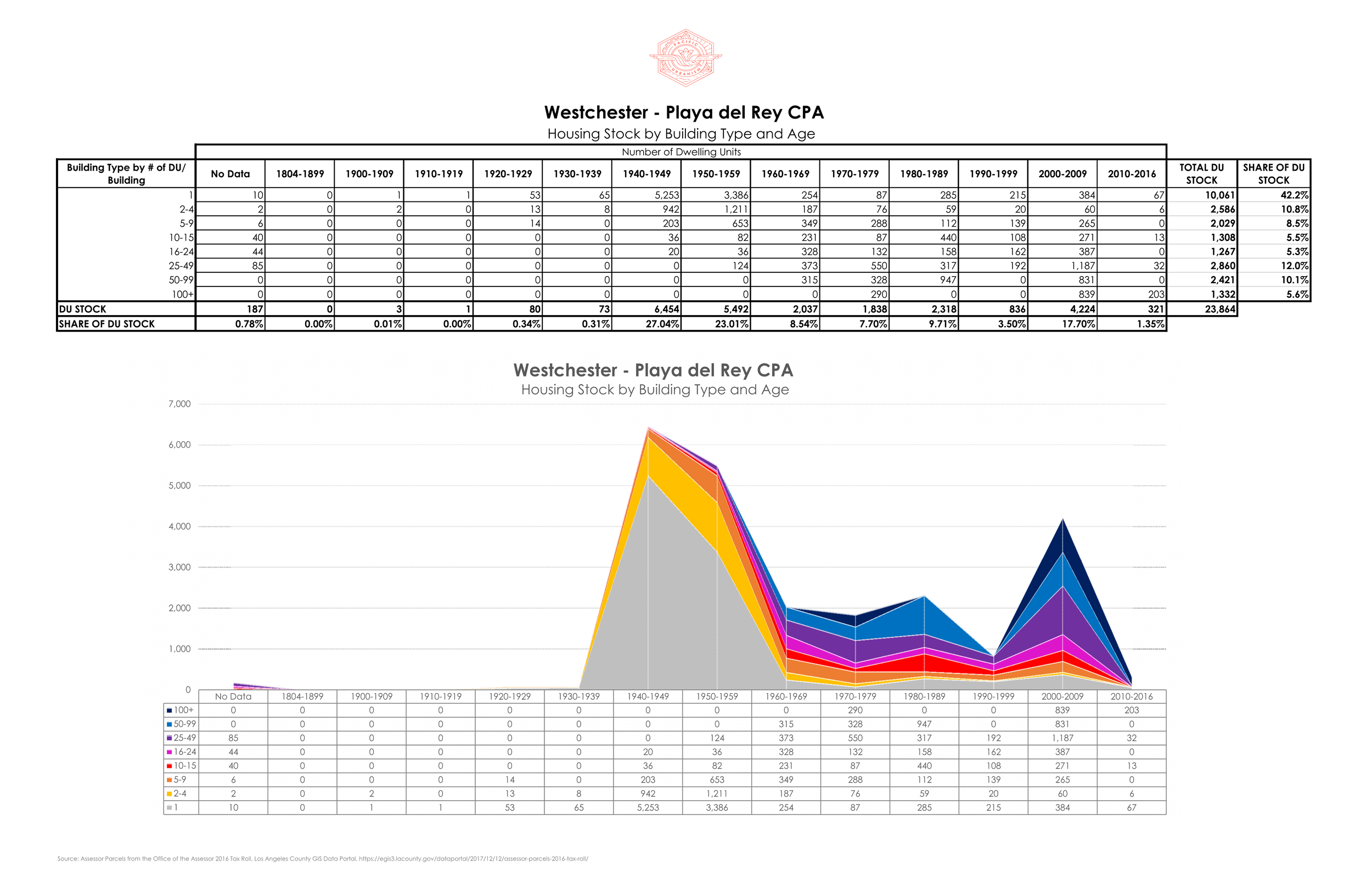
HOUSING STOCK BY COMMUNITY PLAN AREA
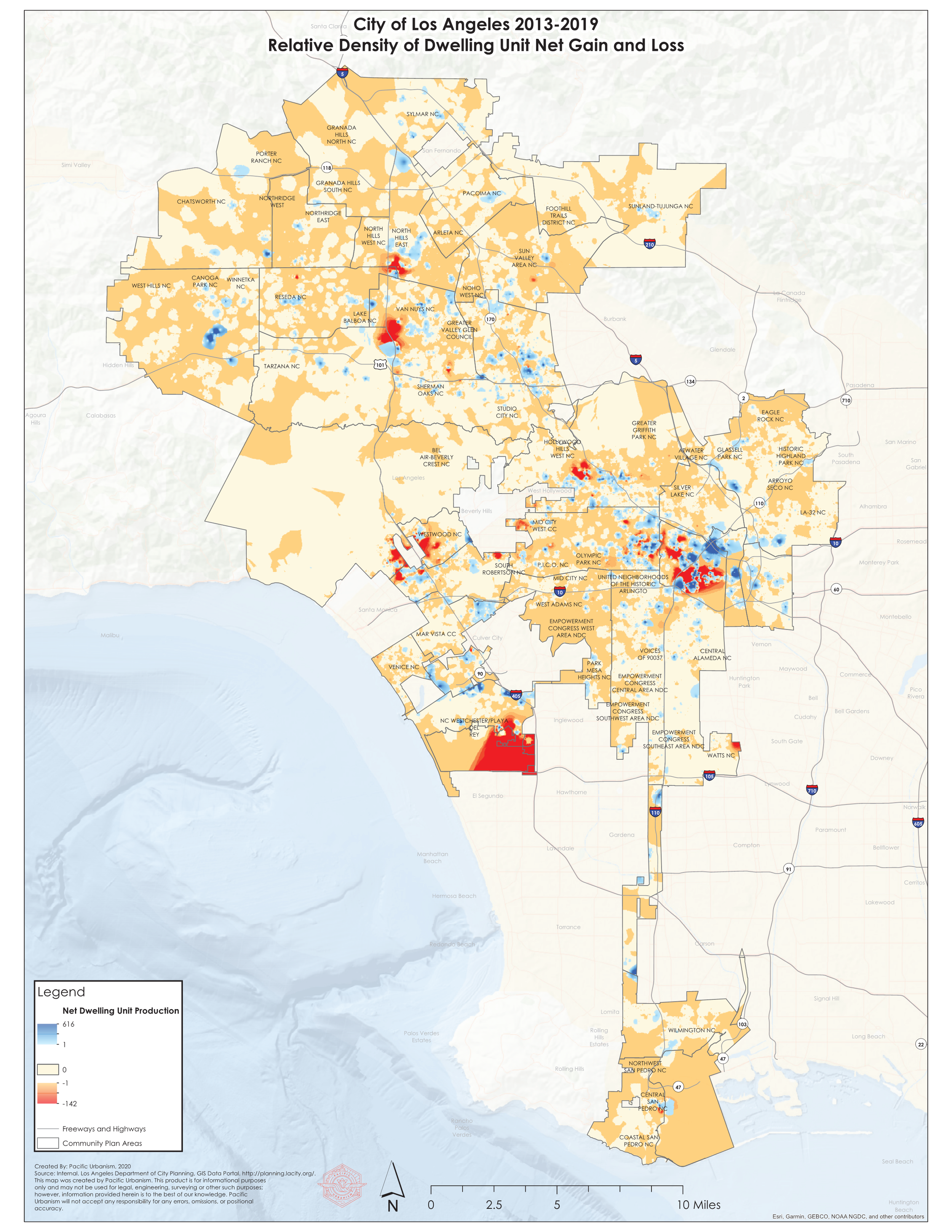
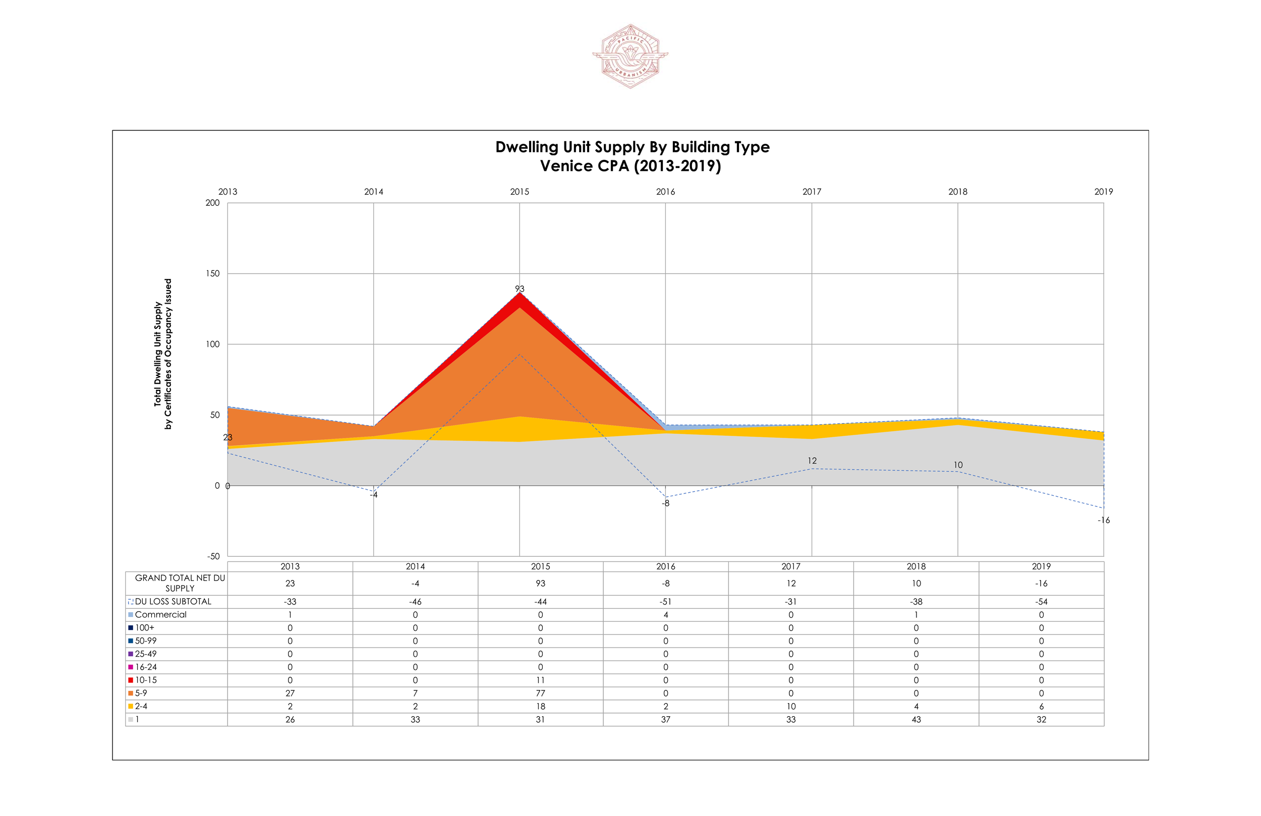
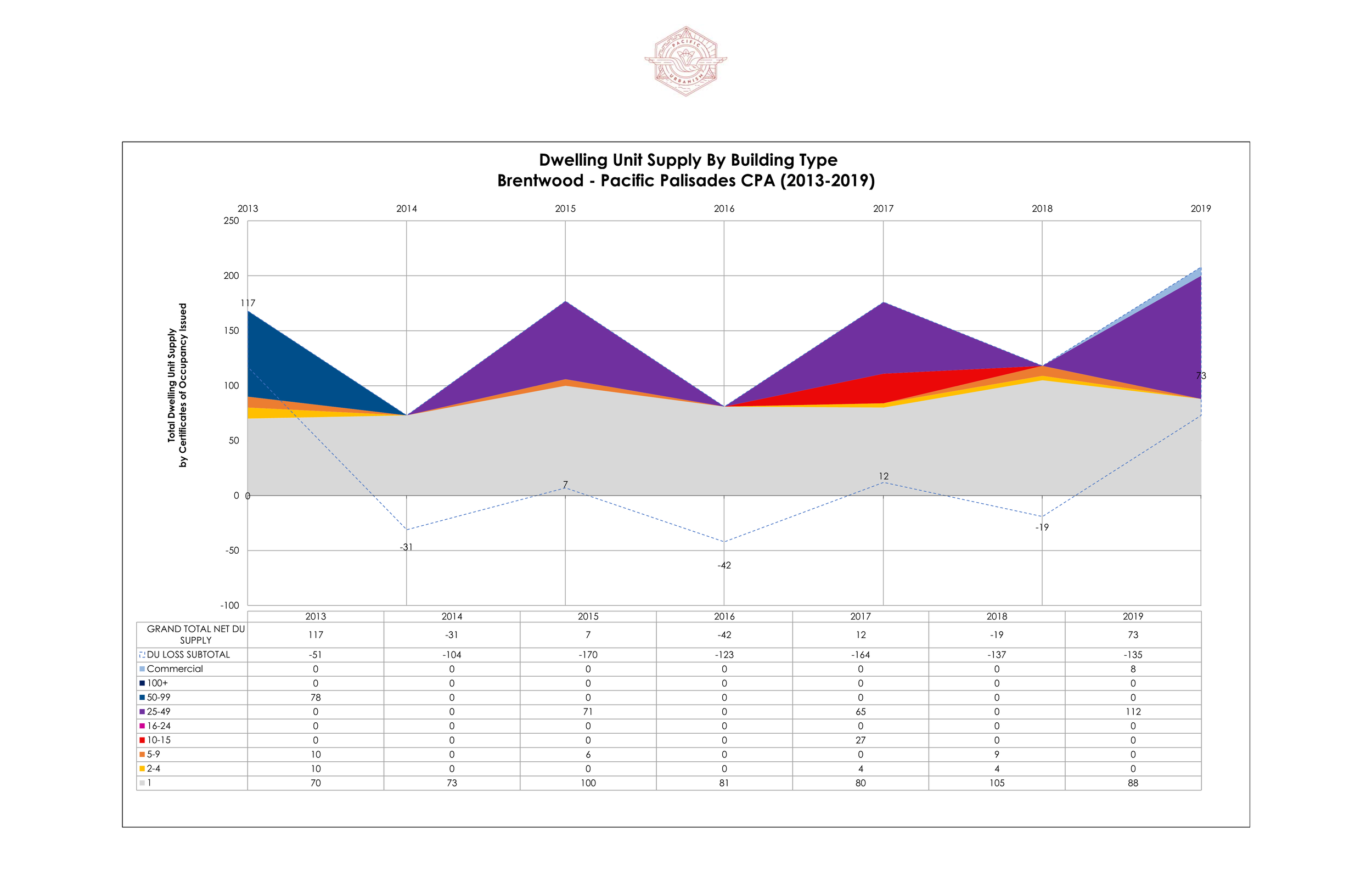
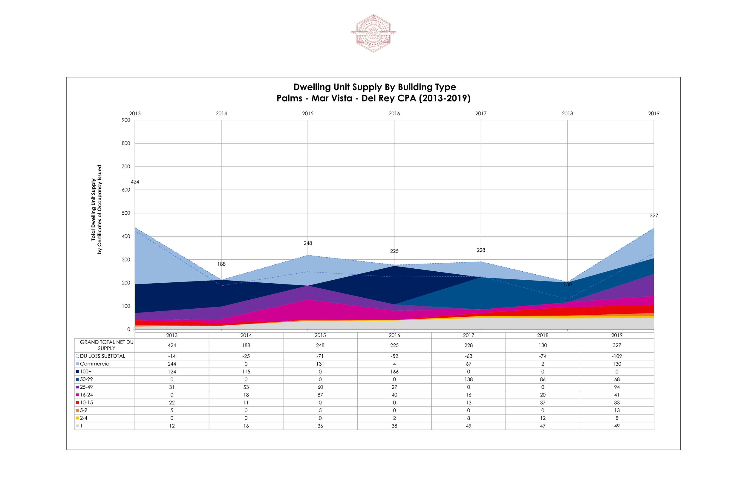
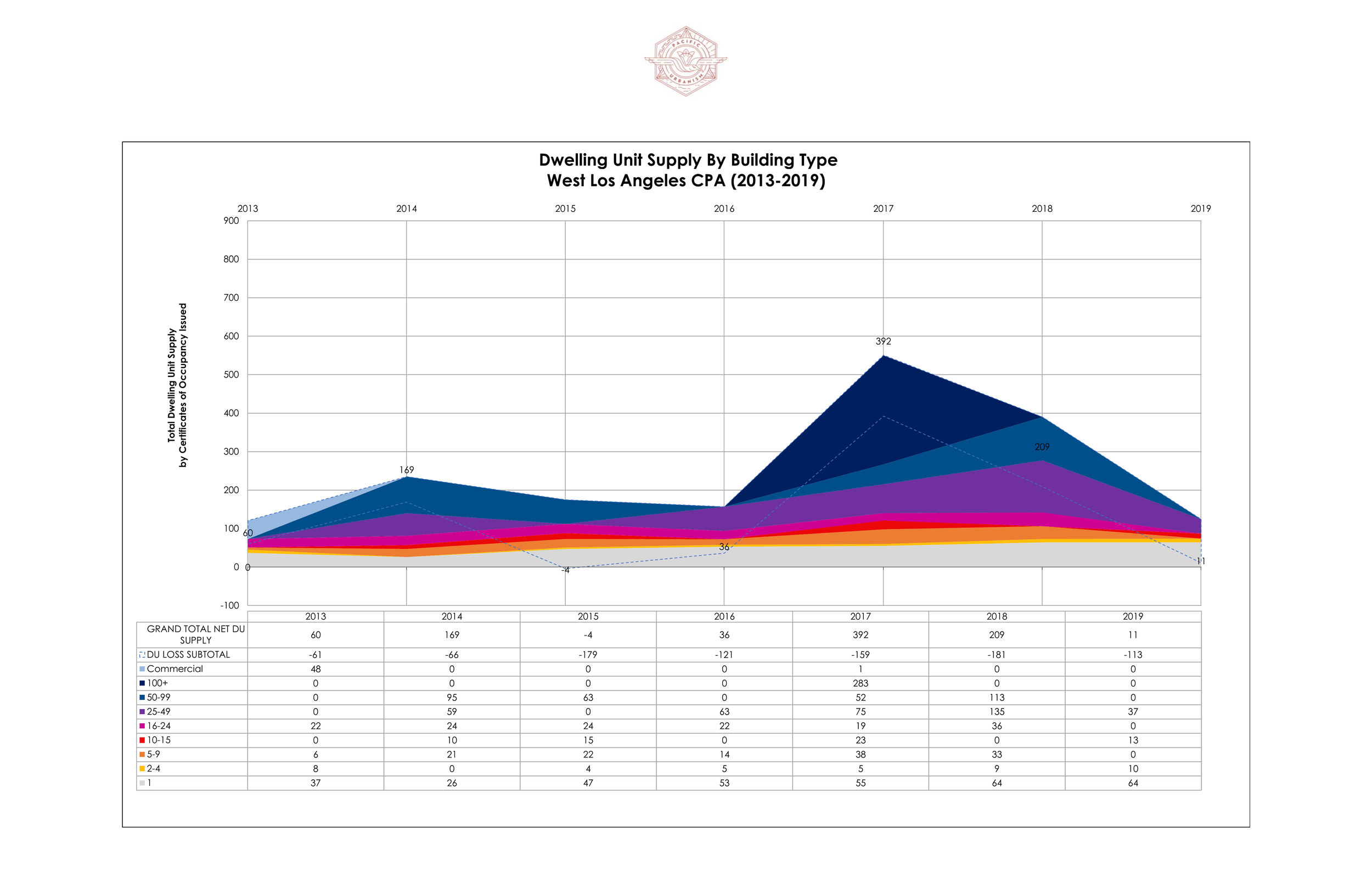
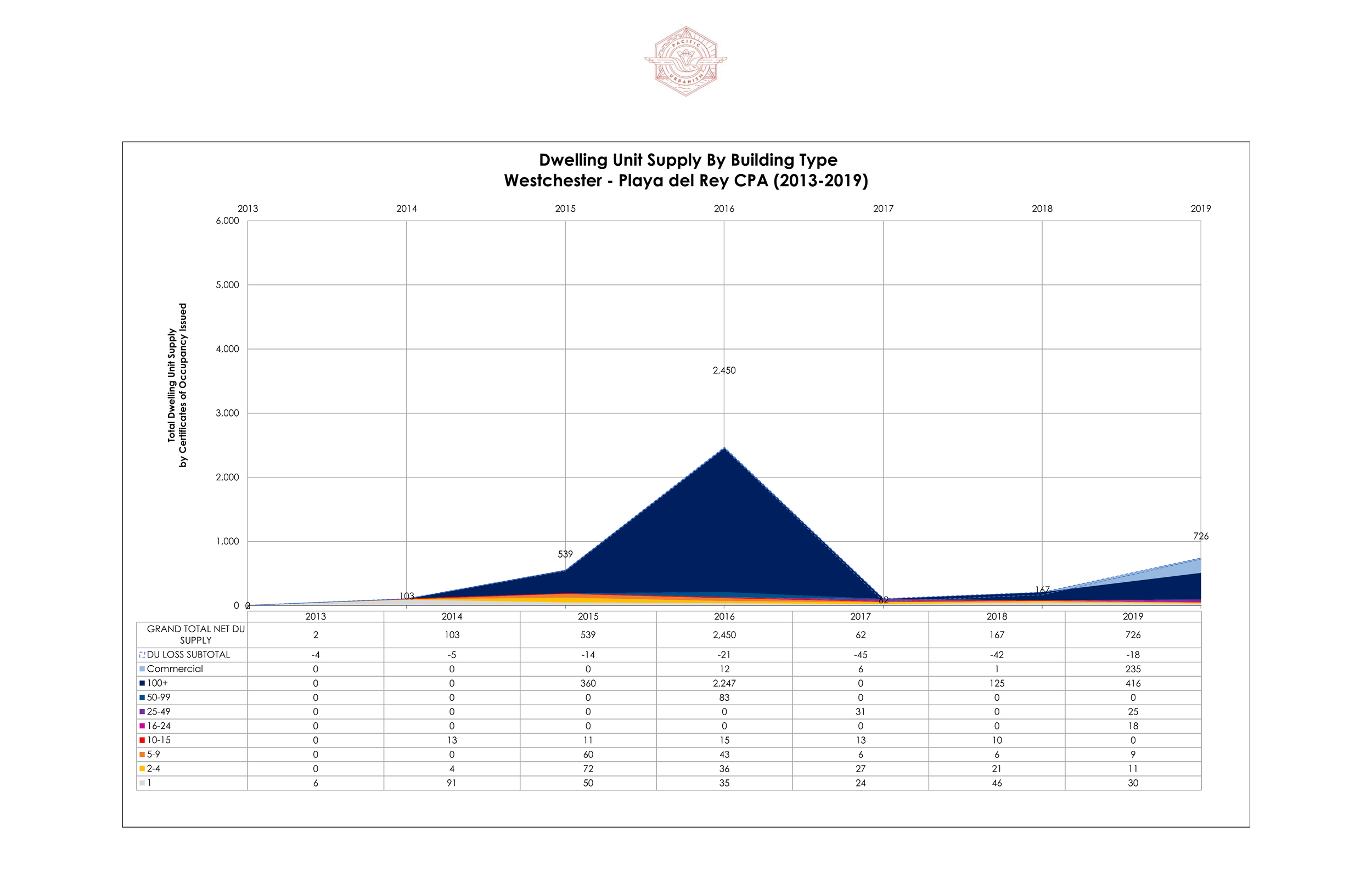
CERTIFICATES OF OCCUPANCY ISSUED BY COMMUNITY PLAN AREA
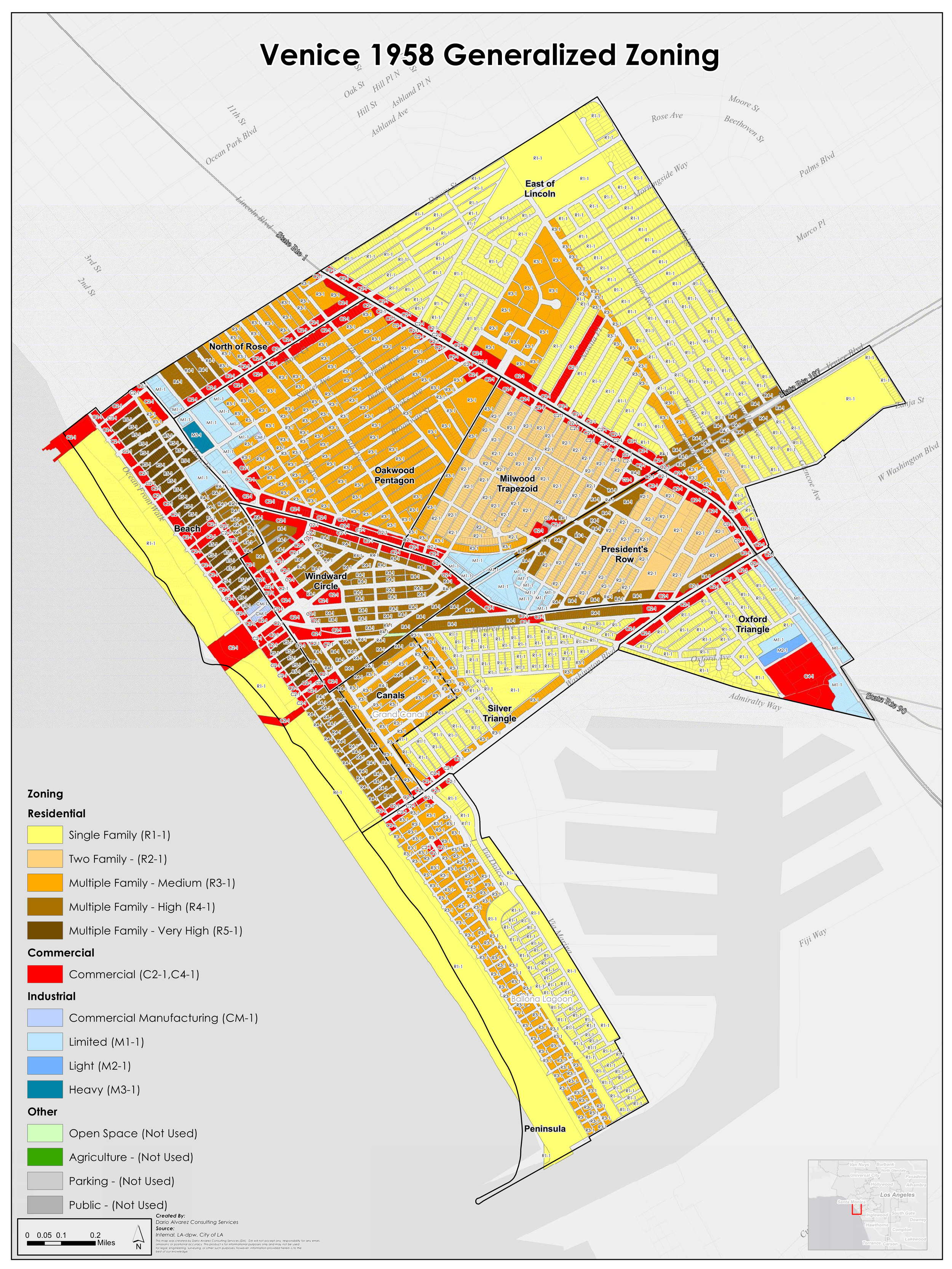
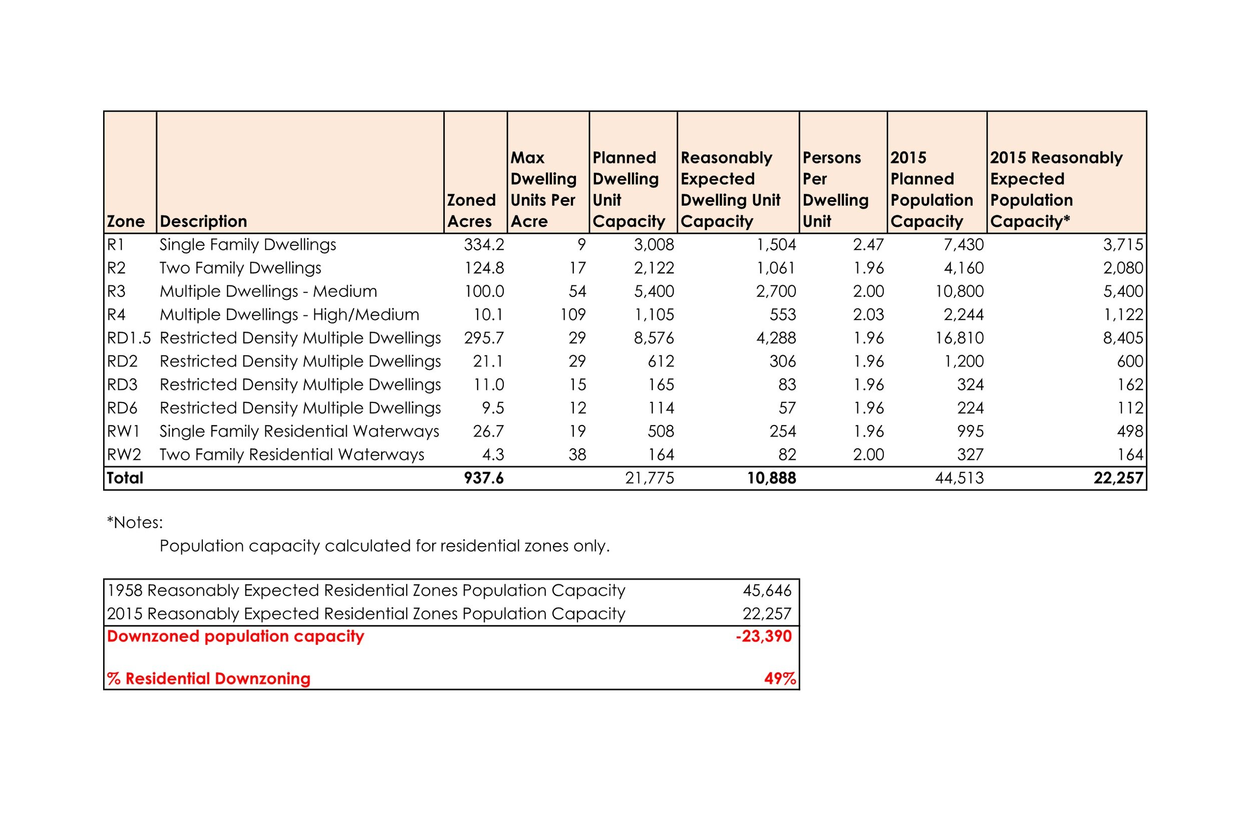
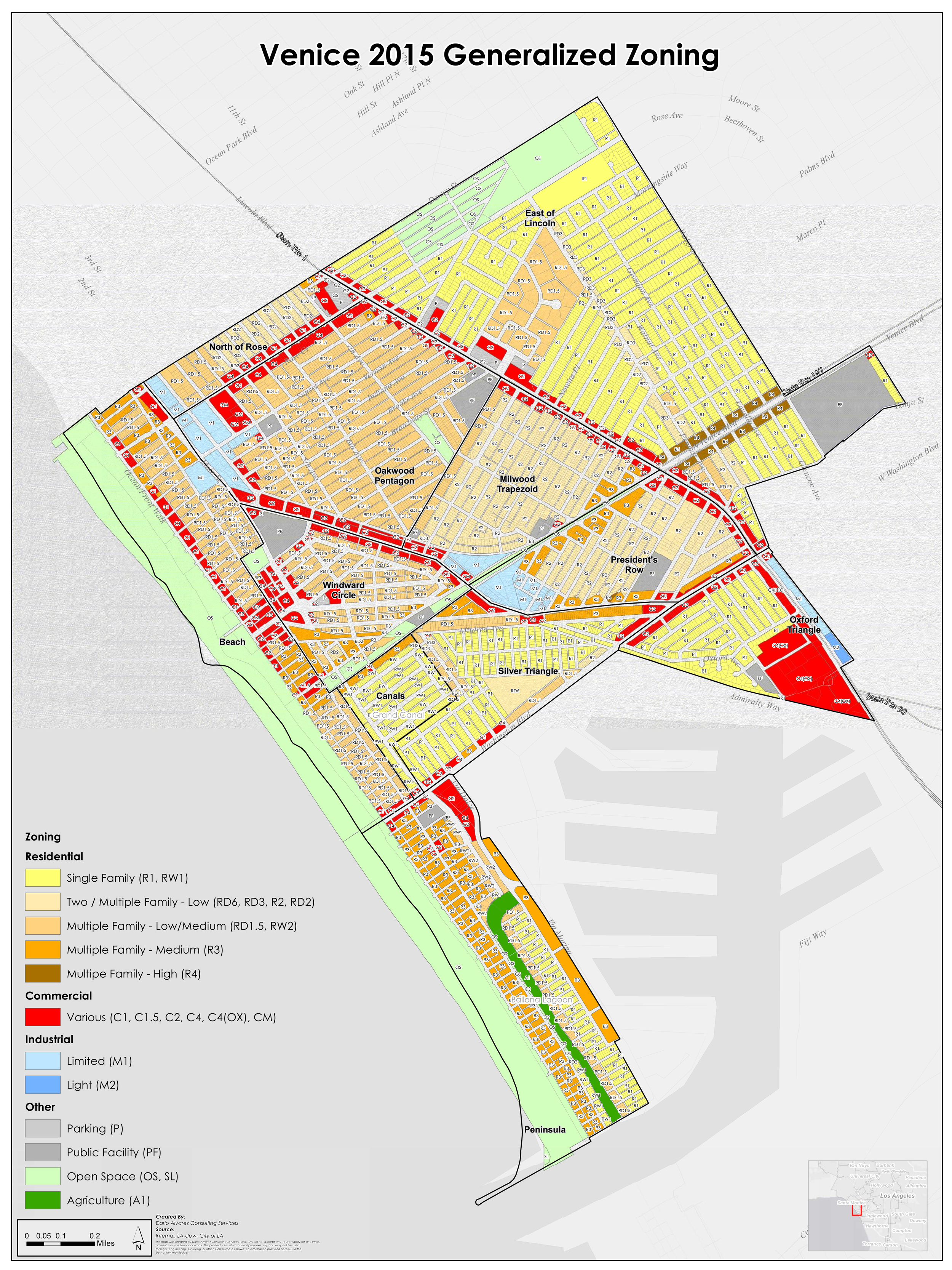
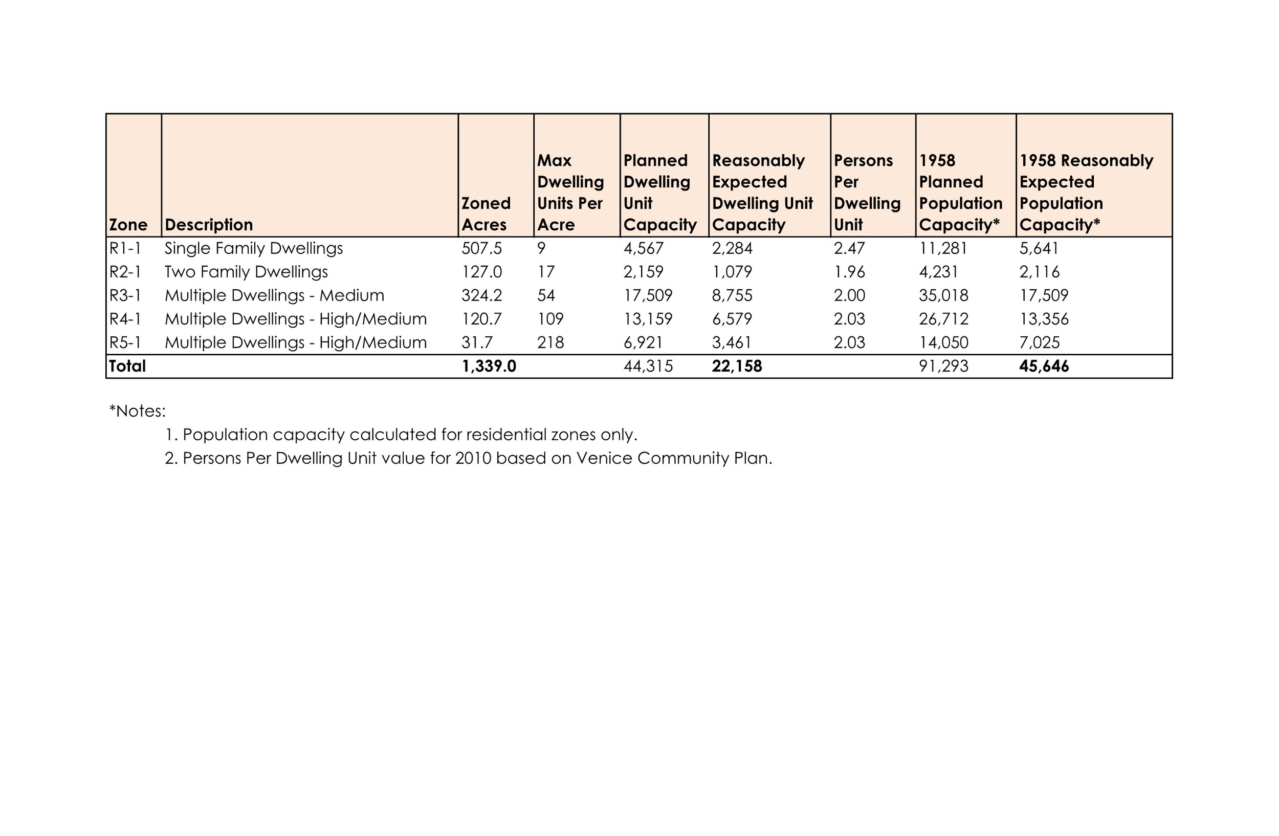
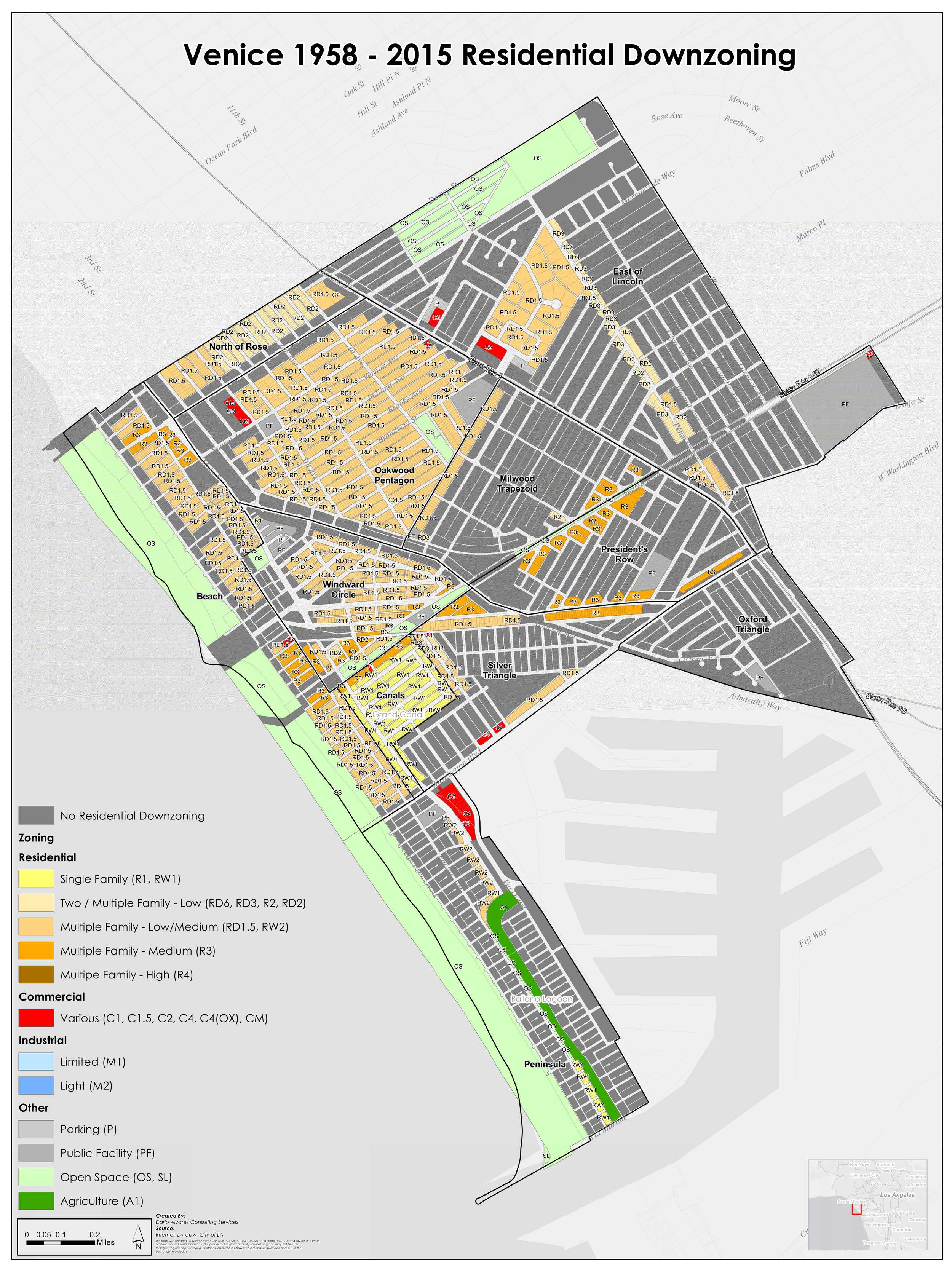
HISTORIC DOWNZONING
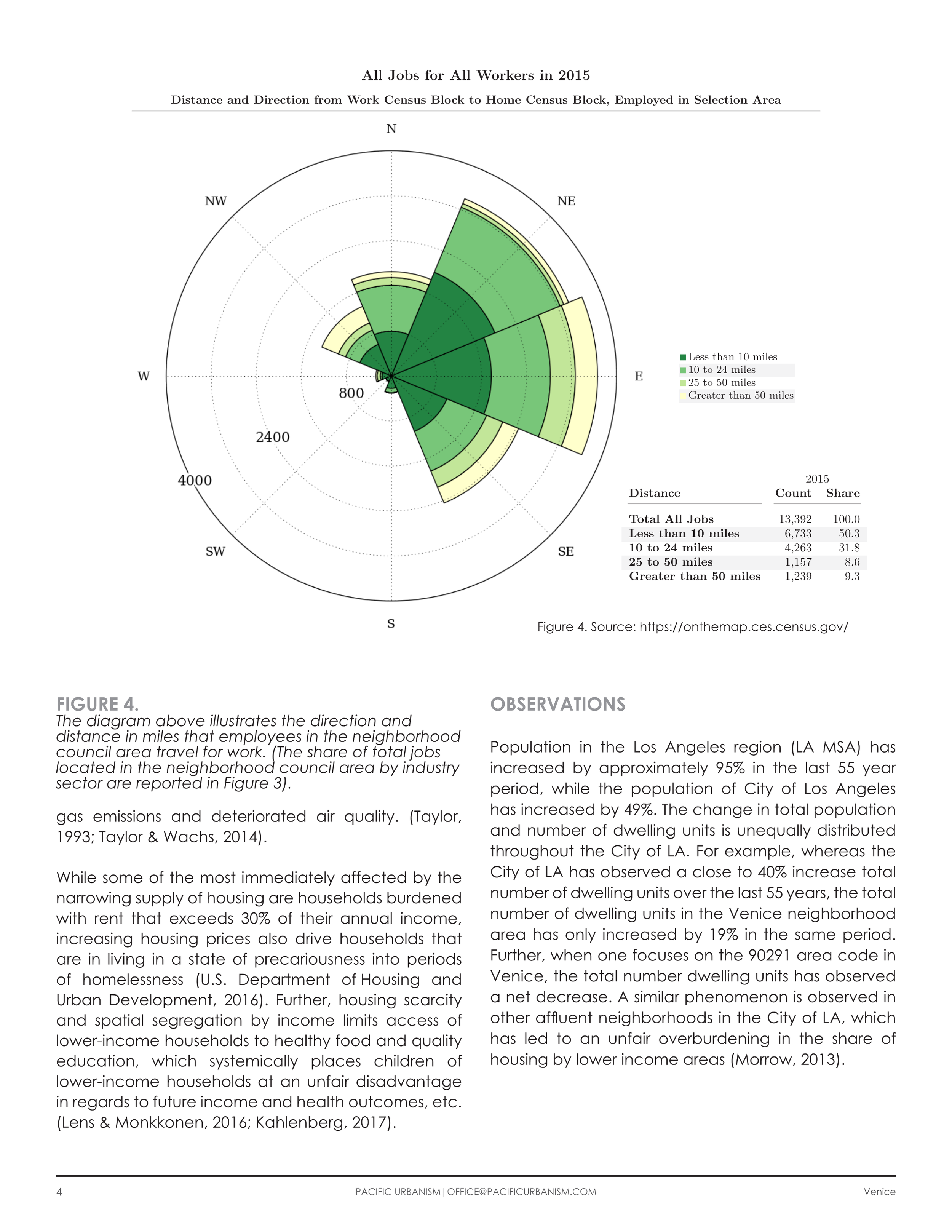
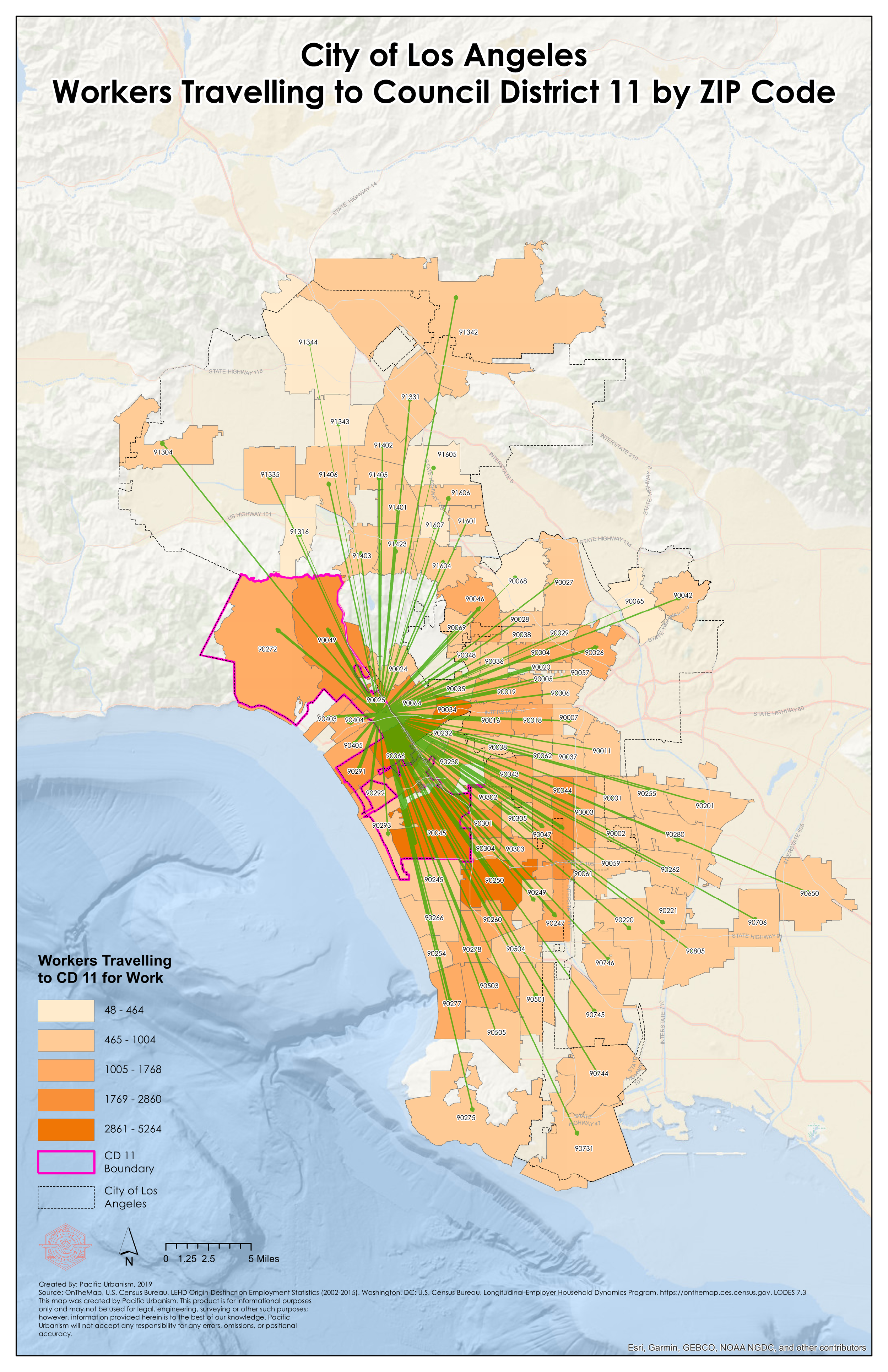
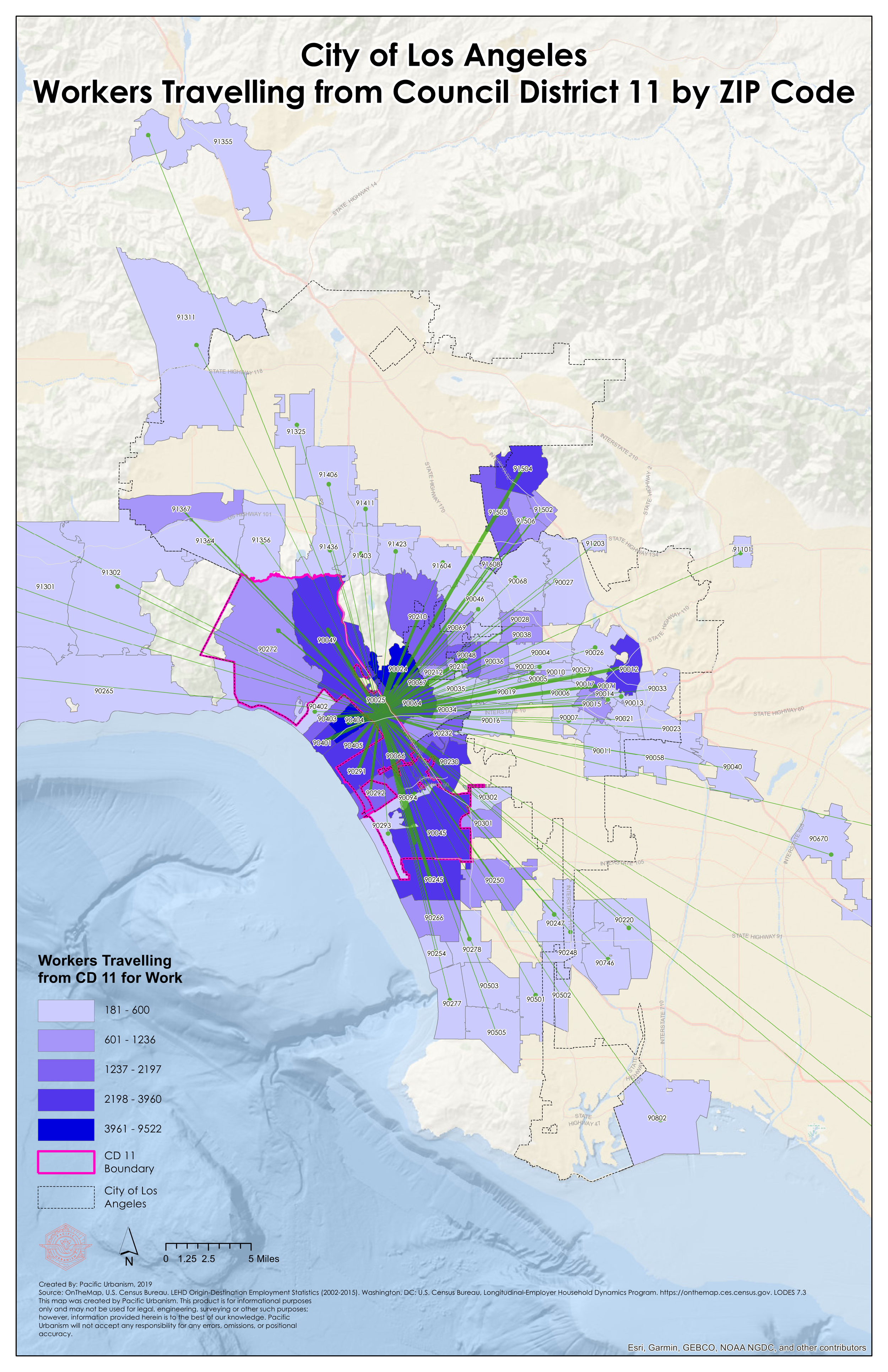
COMMUTER TRENDS
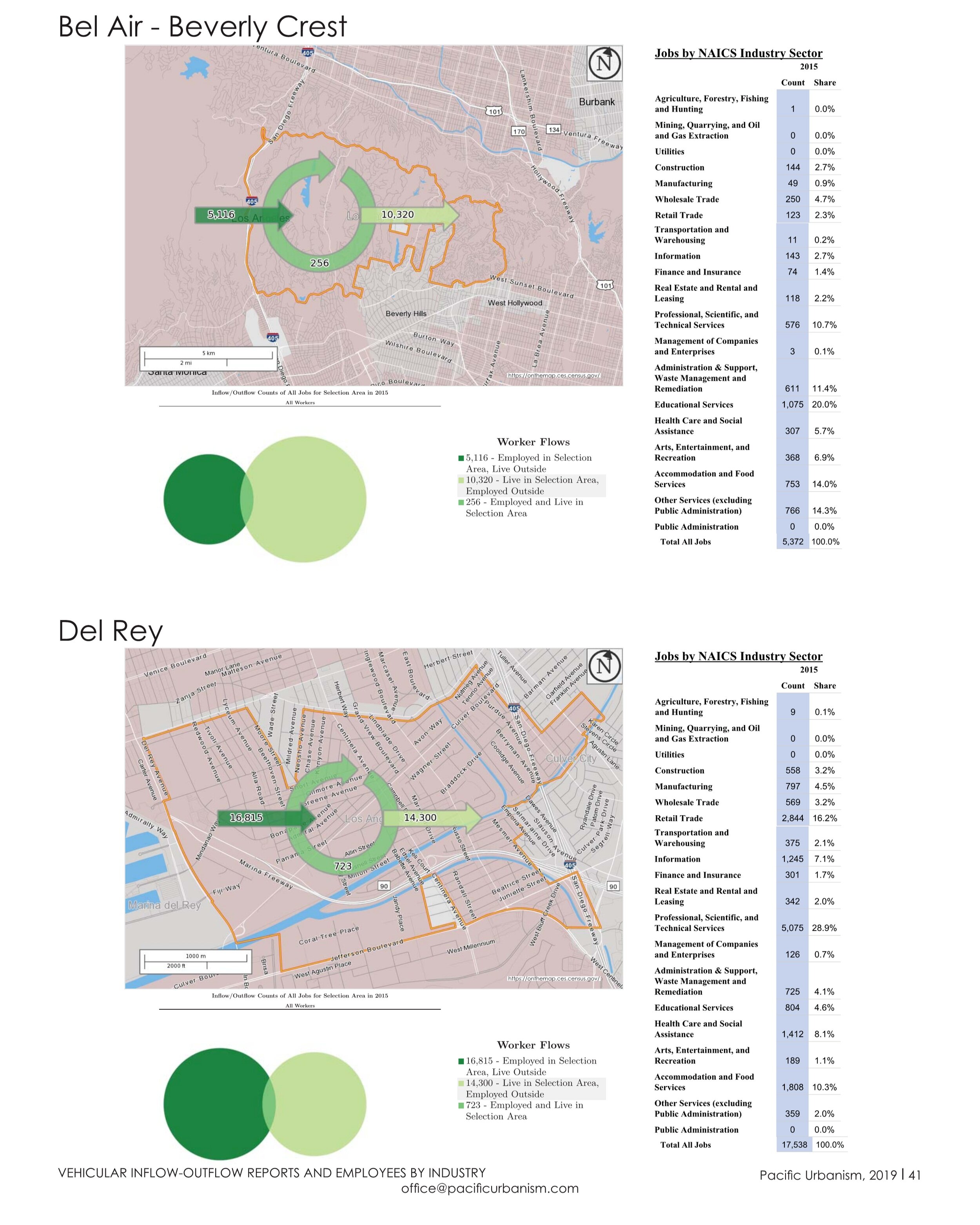
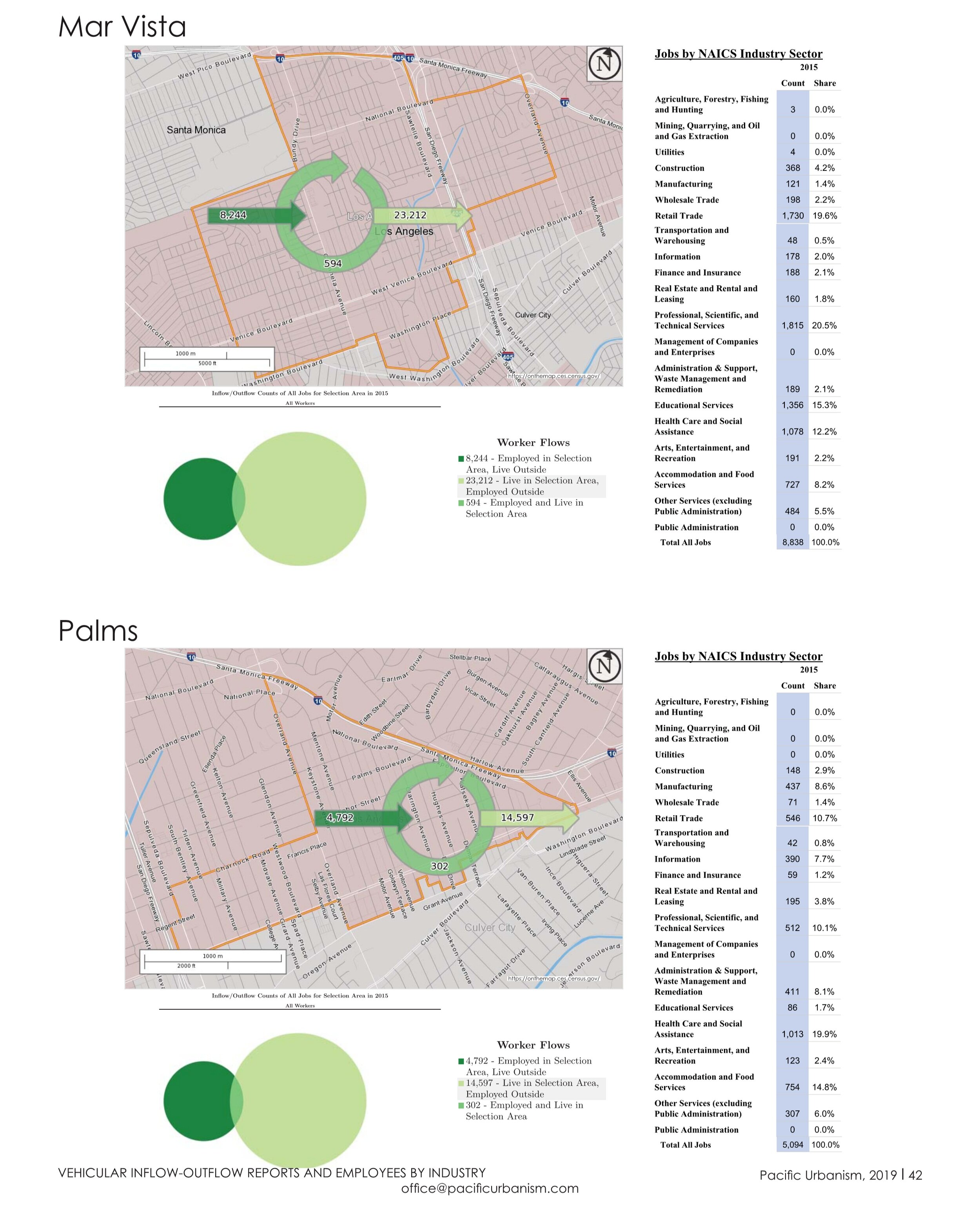
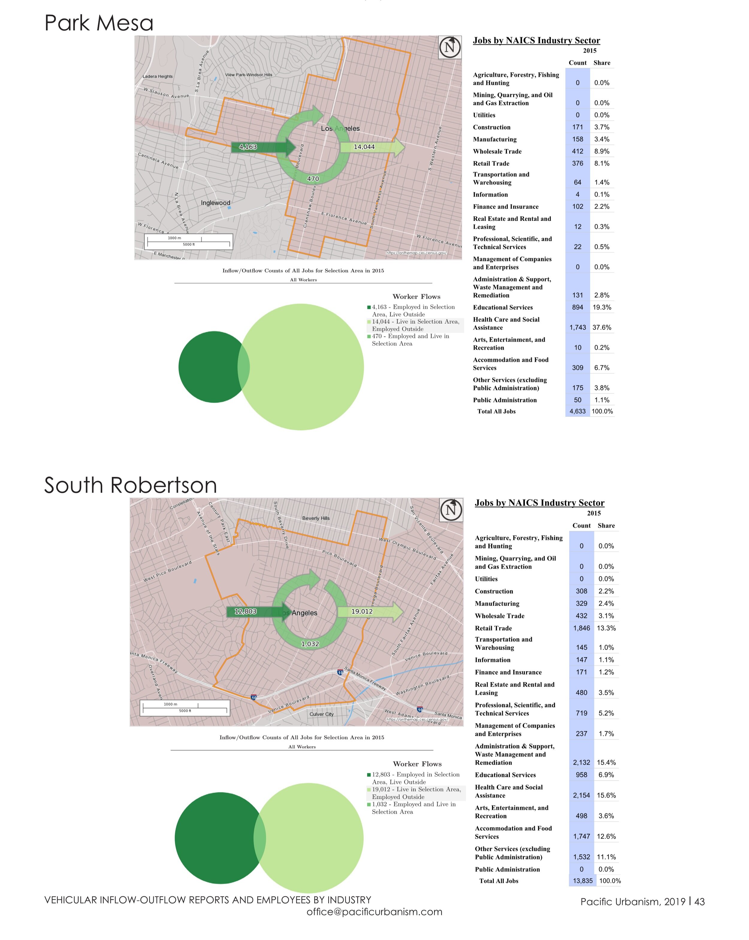
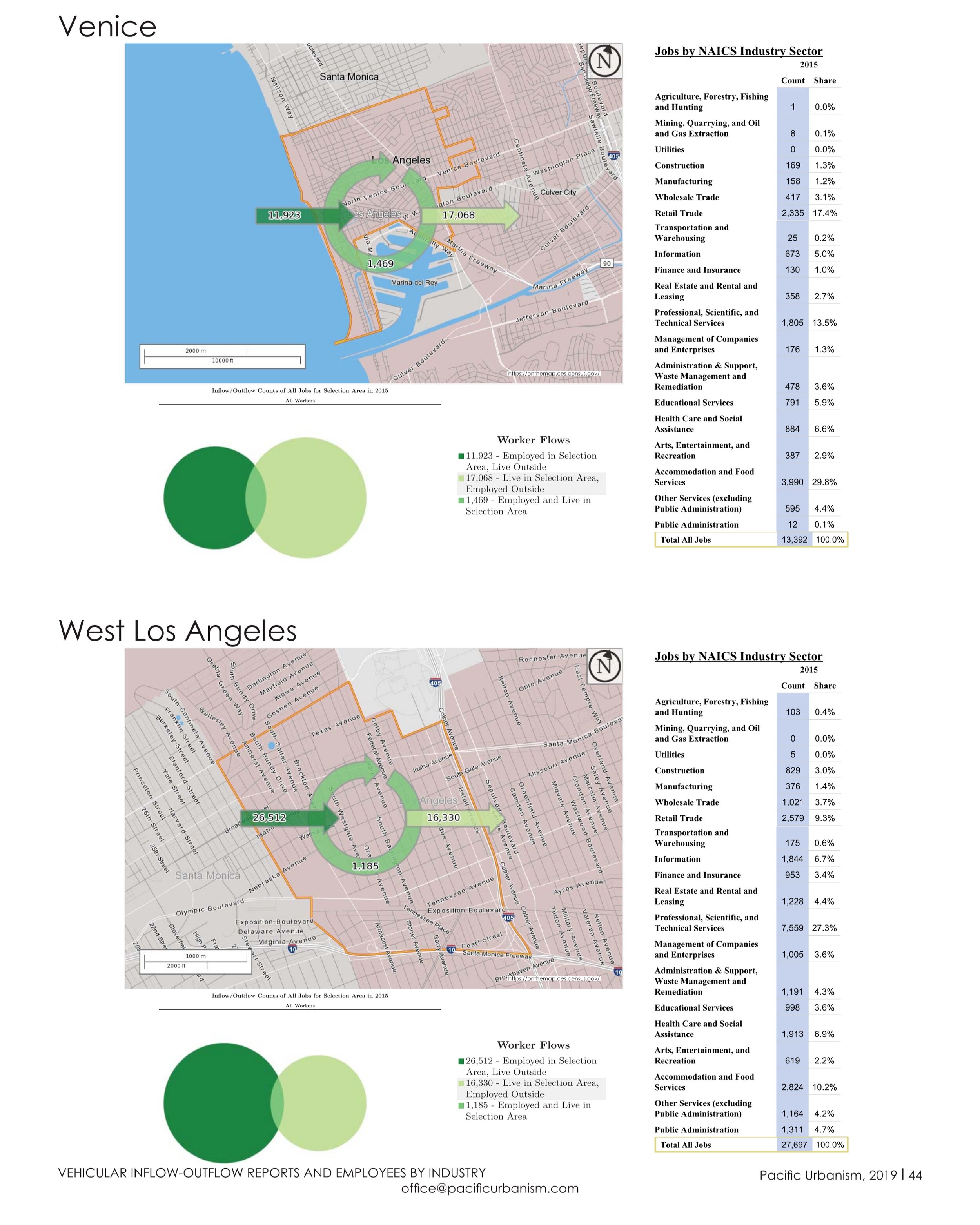
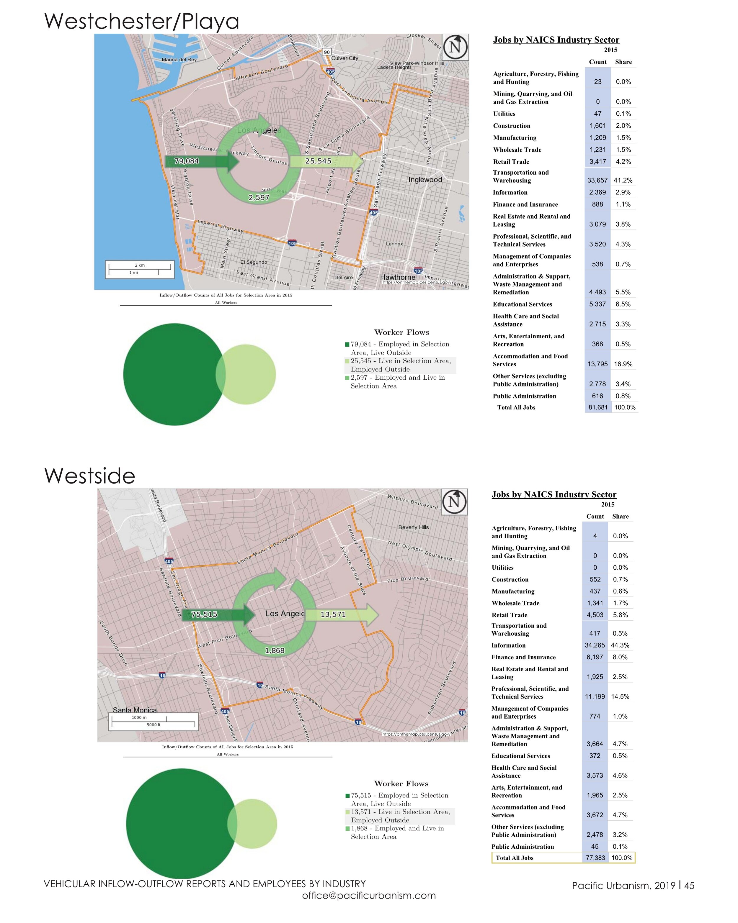
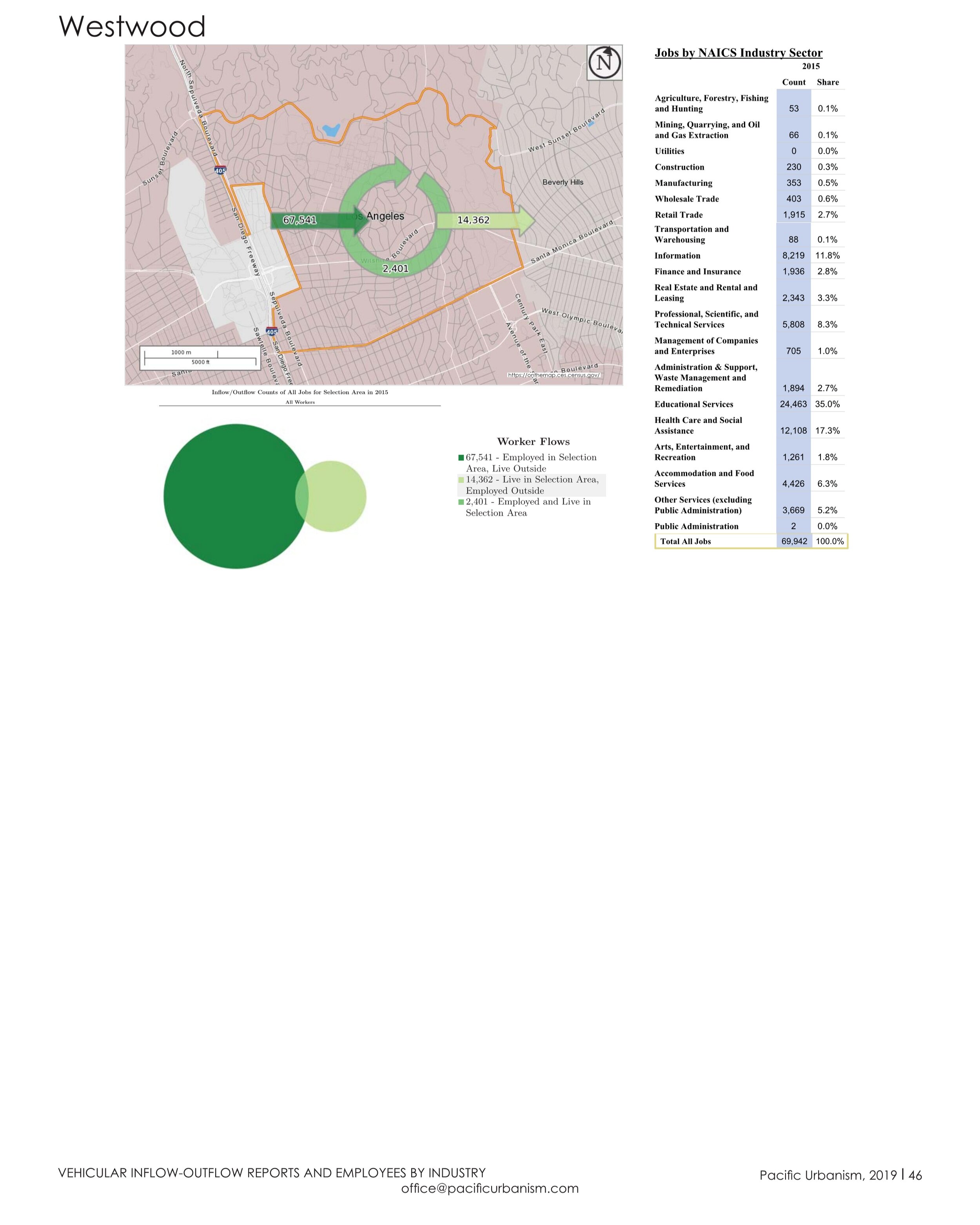
ECONOMIC PROFILE